You are here: Home > Network List > TA - USArray Transportable Network (new EarthScope stations) Stations List
> Station H31M Peel River, Yukon, CAN > Earthquake Result Viewer
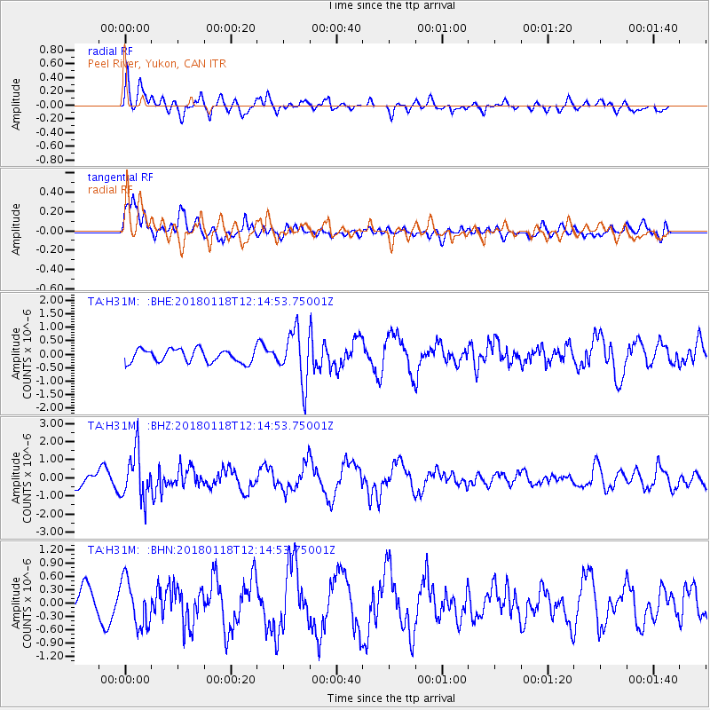
H31M Peel River, Yukon, CAN - Earthquake Result Viewer
*The percent match for this event was below the threshold and hence no stack was calculated.
| Earthquake location: |
Northwest Of Kuril Islands |
| Earthquake latitude/longitude: |
52.6/153.0 |
| Earthquake time(UTC): |
2018/01/18 (018) 12:08:52 GMT |
| Earthquake Depth: |
448 km |
| Earthquake Magnitude: |
5.7 Mww |
| Earthquake Catalog/Contributor: |
NEIC PDE/us |
|
| Network: |
TA USArray Transportable Network (new EarthScope stations) |
| Station: |
H31M Peel River, Yukon, CAN |
| Lat/Lon: |
65.81 N/134.34 W |
| Elevation: |
642 m |
|
| Distance: |
37.2 deg |
| Az: |
40.604 deg |
| Baz: |
285.431 deg |
| Ray Param: |
$rayparam |
*The percent match for this event was below the threshold and hence was not used in the summary stack. |
|
| Radial Match: |
71.144394 % |
| Radial Bump: |
400 |
| Transverse Match: |
71.9749 % |
| Transverse Bump: |
400 |
| SOD ConfigId: |
13570011 |
| Insert Time: |
2019-04-29 14:29:39.111 +0000 |
| GWidth: |
2.5 |
| Max Bumps: |
400 |
| Tol: |
0.001 |
|
Signal To Noise
| Channel | StoN | STA | LTA |
| TA:H31M: :BHZ:20180118T12:14:53.75001Z | 3.7873688 | 1.3091058E-6 | 3.4565045E-7 |
| TA:H31M: :BHN:20180118T12:14:53.75001Z | 1.5099258 | 5.265124E-7 | 3.4870084E-7 |
| TA:H31M: :BHE:20180118T12:14:53.75001Z | 4.018042 | 9.675913E-7 | 2.4081163E-7 |
| Arrivals |
| Ps | |
| PpPs | |
| PsPs/PpSs | |


