You are here: Home > Network List > TA - USArray Transportable Network (new EarthScope stations) Stations List
> Station I30M Mount Dempster, Yukon, CAN > Earthquake Result Viewer
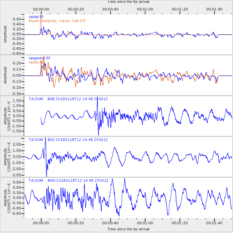
I30M Mount Dempster, Yukon, CAN - Earthquake Result Viewer
*The percent match for this event was below the threshold and hence no stack was calculated.
| Earthquake location: |
Northwest Of Kuril Islands |
| Earthquake latitude/longitude: |
52.6/153.0 |
| Earthquake time(UTC): |
2018/01/18 (018) 12:08:52 GMT |
| Earthquake Depth: |
448 km |
| Earthquake Magnitude: |
5.7 Mww |
| Earthquake Catalog/Contributor: |
NEIC PDE/us |
|
| Network: |
TA USArray Transportable Network (new EarthScope stations) |
| Station: |
I30M Mount Dempster, Yukon, CAN |
| Lat/Lon: |
65.22 N/136.38 W |
| Elevation: |
1399 m |
|
| Distance: |
36.5 deg |
| Az: |
41.913 deg |
| Baz: |
284.629 deg |
| Ray Param: |
$rayparam |
*The percent match for this event was below the threshold and hence was not used in the summary stack. |
|
| Radial Match: |
64.89906 % |
| Radial Bump: |
400 |
| Transverse Match: |
71.821785 % |
| Transverse Bump: |
400 |
| SOD ConfigId: |
13570011 |
| Insert Time: |
2019-04-29 14:29:44.018 +0000 |
| GWidth: |
2.5 |
| Max Bumps: |
400 |
| Tol: |
0.001 |
|
Signal To Noise
| Channel | StoN | STA | LTA |
| TA:I30M: :BHZ:20180118T12:14:48.25001Z | 2.8963747 | 1.3090054E-6 | 4.5194614E-7 |
| TA:I30M: :BHN:20180118T12:14:48.25001Z | 1.4416887 | 2.9859302E-7 | 2.0711339E-7 |
| TA:I30M: :BHE:20180118T12:14:48.25001Z | 2.6441114 | 7.321771E-7 | 2.7690857E-7 |
| Arrivals |
| Ps | |
| PpPs | |
| PsPs/PpSs | |


