You are here: Home > Network List > TA - USArray Transportable Network (new EarthScope stations) Stations List
> Station J25K Salcha River, AK, USA > Earthquake Result Viewer
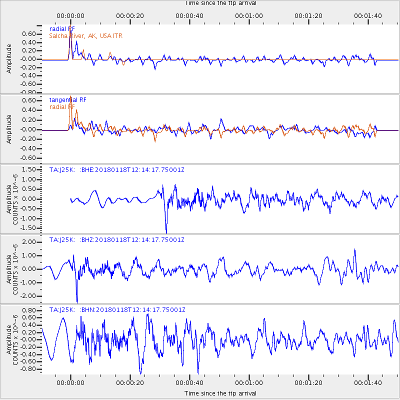
J25K Salcha River, AK, USA - Earthquake Result Viewer
*The percent match for this event was below the threshold and hence no stack was calculated.
| Earthquake location: |
Northwest Of Kuril Islands |
| Earthquake latitude/longitude: |
52.6/153.0 |
| Earthquake time(UTC): |
2018/01/18 (018) 12:08:52 GMT |
| Earthquake Depth: |
448 km |
| Earthquake Magnitude: |
5.7 Mww |
| Earthquake Catalog/Contributor: |
NEIC PDE/us |
|
| Network: |
TA USArray Transportable Network (new EarthScope stations) |
| Station: |
J25K Salcha River, AK, USA |
| Lat/Lon: |
64.61 N/145.37 W |
| Elevation: |
949 m |
|
| Distance: |
32.9 deg |
| Az: |
44.309 deg |
| Baz: |
278.461 deg |
| Ray Param: |
$rayparam |
*The percent match for this event was below the threshold and hence was not used in the summary stack. |
|
| Radial Match: |
66.94183 % |
| Radial Bump: |
400 |
| Transverse Match: |
59.756687 % |
| Transverse Bump: |
400 |
| SOD ConfigId: |
13570011 |
| Insert Time: |
2019-04-29 14:29:44.426 +0000 |
| GWidth: |
2.5 |
| Max Bumps: |
400 |
| Tol: |
0.001 |
|
Signal To Noise
| Channel | StoN | STA | LTA |
| TA:J25K: :BHZ:20180118T12:14:17.75001Z | 3.3882802 | 7.9282194E-7 | 2.339895E-7 |
| TA:J25K: :BHN:20180118T12:14:17.75001Z | 1.0966922 | 3.4019098E-7 | 3.1019732E-7 |
| TA:J25K: :BHE:20180118T12:14:17.75001Z | 3.263653 | 5.6791504E-7 | 1.7401207E-7 |
| Arrivals |
| Ps | |
| PpPs | |
| PsPs/PpSs | |


