You are here: Home > Network List > TA - USArray Transportable Network (new EarthScope stations) Stations List
> Station K29M Barlow Dome, YT, CAN > Earthquake Result Viewer
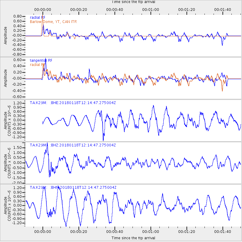
K29M Barlow Dome, YT, CAN - Earthquake Result Viewer
*The percent match for this event was below the threshold and hence no stack was calculated.
| Earthquake location: |
Northwest Of Kuril Islands |
| Earthquake latitude/longitude: |
52.6/153.0 |
| Earthquake time(UTC): |
2018/01/18 (018) 12:08:52 GMT |
| Earthquake Depth: |
448 km |
| Earthquake Magnitude: |
5.7 Mww |
| Earthquake Catalog/Contributor: |
NEIC PDE/us |
|
| Network: |
TA USArray Transportable Network (new EarthScope stations) |
| Station: |
K29M Barlow Dome, YT, CAN |
| Lat/Lon: |
63.84 N/137.52 W |
| Elevation: |
1367 m |
|
| Distance: |
36.4 deg |
| Az: |
44.379 deg |
| Baz: |
285.581 deg |
| Ray Param: |
$rayparam |
*The percent match for this event was below the threshold and hence was not used in the summary stack. |
|
| Radial Match: |
62.920692 % |
| Radial Bump: |
400 |
| Transverse Match: |
71.354095 % |
| Transverse Bump: |
400 |
| SOD ConfigId: |
13570011 |
| Insert Time: |
2019-04-29 14:29:49.466 +0000 |
| GWidth: |
2.5 |
| Max Bumps: |
400 |
| Tol: |
0.001 |
|
Signal To Noise
| Channel | StoN | STA | LTA |
| TA:K29M: :BHZ:20180118T12:14:47.275004Z | 2.6278796 | 9.763995E-7 | 3.715541E-7 |
| TA:K29M: :BHN:20180118T12:14:47.275004Z | 2.0041134 | 7.4925936E-7 | 3.7386073E-7 |
| TA:K29M: :BHE:20180118T12:14:47.275004Z | 2.7210684 | 6.1546217E-7 | 2.2618401E-7 |
| Arrivals |
| Ps | |
| PpPs | |
| PsPs/PpSs | |


