You are here: Home > Network List > TA - USArray Transportable Network (new EarthScope stations) Stations List
> Station N25K Chitina, Valdez-Cordova, AK, USA > Earthquake Result Viewer
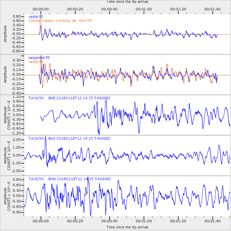
N25K Chitina, Valdez-Cordova, AK, USA - Earthquake Result Viewer
*The percent match for this event was below the threshold and hence no stack was calculated.
| Earthquake location: |
Northwest Of Kuril Islands |
| Earthquake latitude/longitude: |
52.6/153.0 |
| Earthquake time(UTC): |
2018/01/18 (018) 12:08:52 GMT |
| Earthquake Depth: |
448 km |
| Earthquake Magnitude: |
5.7 Mww |
| Earthquake Catalog/Contributor: |
NEIC PDE/us |
|
| Network: |
TA USArray Transportable Network (new EarthScope stations) |
| Station: |
N25K Chitina, Valdez-Cordova, AK, USA |
| Lat/Lon: |
61.61 N/144.60 W |
| Elevation: |
1087 m |
|
| Distance: |
33.8 deg |
| Az: |
49.577 deg |
| Baz: |
283.55 deg |
| Ray Param: |
$rayparam |
*The percent match for this event was below the threshold and hence was not used in the summary stack. |
|
| Radial Match: |
56.54458 % |
| Radial Bump: |
400 |
| Transverse Match: |
56.08155 % |
| Transverse Bump: |
400 |
| SOD ConfigId: |
13570011 |
| Insert Time: |
2019-04-29 14:30:01.678 +0000 |
| GWidth: |
2.5 |
| Max Bumps: |
400 |
| Tol: |
0.001 |
|
Signal To Noise
| Channel | StoN | STA | LTA |
| TA:N25K: :BHZ:20180118T12:14:25.549998Z | 2.5460544 | 9.3364406E-7 | 3.667023E-7 |
| TA:N25K: :BHN:20180118T12:14:25.549998Z | 1.6514522 | 4.4767157E-7 | 2.7107754E-7 |
| TA:N25K: :BHE:20180118T12:14:25.549998Z | 3.2758694 | 6.215079E-7 | 1.8972304E-7 |
| Arrivals |
| Ps | |
| PpPs | |
| PsPs/PpSs | |


