You are here: Home > Network List > TJ - Tajikistan National Seismic Network Stations List
> Station GARM Garm, Tajikistan > Earthquake Result Viewer
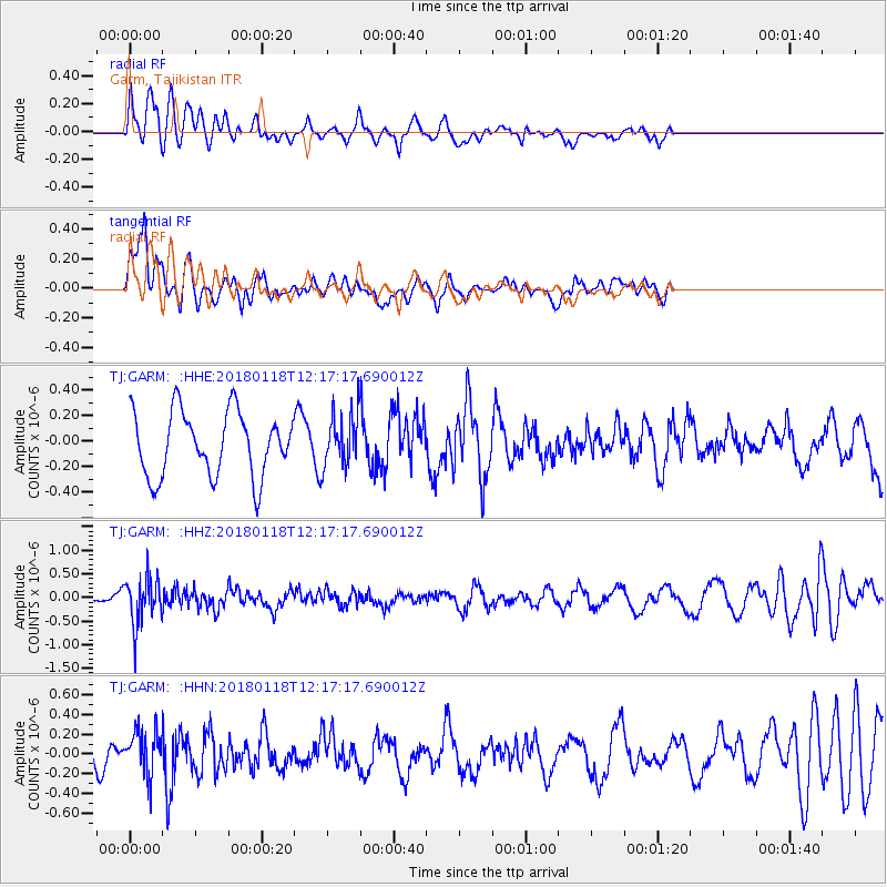
GARM Garm, Tajikistan - Earthquake Result Viewer
*The percent match for this event was below the threshold and hence no stack was calculated.
| Earthquake location: |
Northwest Of Kuril Islands |
| Earthquake latitude/longitude: |
52.6/153.0 |
| Earthquake time(UTC): |
2018/01/18 (018) 12:08:52 GMT |
| Earthquake Depth: |
448 km |
| Earthquake Magnitude: |
5.7 Mww |
| Earthquake Catalog/Contributor: |
NEIC PDE/us |
|
| Network: |
TJ Tajikistan National Seismic Network |
| Station: |
GARM Garm, Tajikistan |
| Lat/Lon: |
39.00 N/70.32 E |
| Elevation: |
1305 m |
|
| Distance: |
56.1 deg |
| Az: |
291.458 deg |
| Baz: |
46.809 deg |
| Ray Param: |
$rayparam |
*The percent match for this event was below the threshold and hence was not used in the summary stack. |
|
| Radial Match: |
64.57873 % |
| Radial Bump: |
400 |
| Transverse Match: |
71.36282 % |
| Transverse Bump: |
400 |
| SOD ConfigId: |
13570011 |
| Insert Time: |
2019-04-29 14:30:12.643 +0000 |
| GWidth: |
2.5 |
| Max Bumps: |
400 |
| Tol: |
0.001 |
|
Signal To Noise
| Channel | StoN | STA | LTA |
| TJ:GARM: :HHZ:20180118T12:17:17.690012Z | 1.7776682 | 4.942652E-7 | 2.7804128E-7 |
| TJ:GARM: :HHN:20180118T12:17:17.690012Z | 2.0317864 | 2.2449467E-7 | 1.1049127E-7 |
| TJ:GARM: :HHE:20180118T12:17:17.690012Z | 0.81412035 | 2.0485473E-7 | 2.5162709E-7 |
| Arrivals |
| Ps | |
| PpPs | |
| PsPs/PpSs | |


