You are here: Home > Network List > CN - Canadian National Seismograph Network Stations List
> Station INK INUVIK, NT > Earthquake Result Viewer
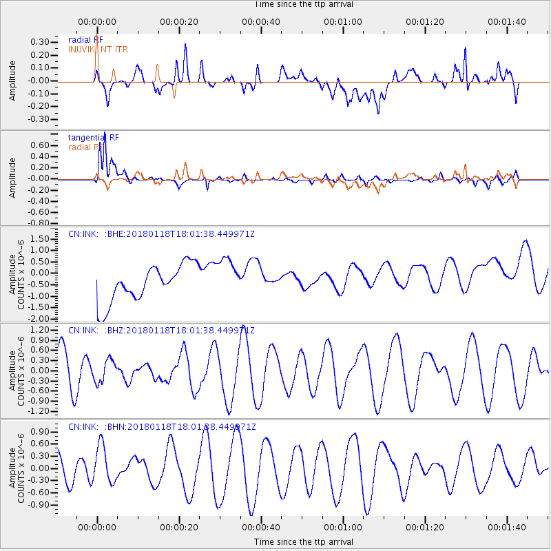
INK INUVIK, NT - Earthquake Result Viewer
*The percent match for this event was below the threshold and hence no stack was calculated.
| Earthquake location: |
Tanimbar Islands Reg., Indonesia |
| Earthquake latitude/longitude: |
-6.4/132.8 |
| Earthquake time(UTC): |
2018/01/18 (018) 17:48:39 GMT |
| Earthquake Depth: |
27 km |
| Earthquake Magnitude: |
5.6 Mww |
| Earthquake Catalog/Contributor: |
NEIC PDE/us |
|
| Network: |
CN Canadian National Seismograph Network |
| Station: |
INK INUVIK, NT |
| Lat/Lon: |
68.31 N/133.53 W |
| Elevation: |
44 m |
|
| Distance: |
97.3 deg |
| Az: |
21.965 deg |
| Baz: |
271.034 deg |
| Ray Param: |
$rayparam |
*The percent match for this event was below the threshold and hence was not used in the summary stack. |
|
| Radial Match: |
20.833443 % |
| Radial Bump: |
400 |
| Transverse Match: |
82.22298 % |
| Transverse Bump: |
400 |
| SOD ConfigId: |
13570011 |
| Insert Time: |
2019-04-29 14:32:42.879 +0000 |
| GWidth: |
2.5 |
| Max Bumps: |
400 |
| Tol: |
0.001 |
|
Signal To Noise
| Channel | StoN | STA | LTA |
| CN:INK: :BHZ:20180118T18:01:38.449971Z | 0.69134754 | 3.3419315E-7 | 4.833938E-7 |
| CN:INK: :BHN:20180118T18:01:38.449971Z | 1.3090688 | 4.9990064E-7 | 3.81875E-7 |
| CN:INK: :BHE:20180118T18:01:38.449971Z | 1.1133863 | 8.9548774E-7 | 8.0429203E-7 |
| Arrivals |
| Ps | |
| PpPs | |
| PsPs/PpSs | |


