You are here: Home > Network List > TA - USArray Transportable Network (new EarthScope stations) Stations List
> Station A21K Barrow, AK, USA > Earthquake Result Viewer
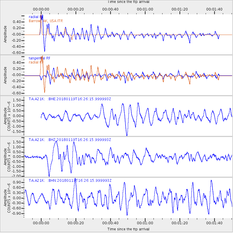
A21K Barrow, AK, USA - Earthquake Result Viewer

| Earthquake location: |
Gulf Of California |
| Earthquake latitude/longitude: |
26.7/-111.1 |
| Earthquake time(UTC): |
2018/01/19 (019) 16:17:42 GMT |
| Earthquake Depth: |
10 km |
| Earthquake Magnitude: |
6.3 Mww |
| Earthquake Catalog/Contributor: |
NEIC PDE/us |
|
| Network: |
TA USArray Transportable Network (new EarthScope stations) |
| Station: |
A21K Barrow, AK, USA |
| Lat/Lon: |
71.32 N/156.62 W |
| Elevation: |
577 m |
|
| Distance: |
51.3 deg |
| Az: |
342.88 deg |
| Baz: |
125.166 deg |
| Ray Param: |
0.06748016 |
| Estimated Moho Depth: |
19.25 km |
| Estimated Crust Vp/Vs: |
2.06 |
| Assumed Crust Vp: |
6.048 km/s |
| Estimated Crust Vs: |
2.936 km/s |
| Estimated Crust Poisson's Ratio: |
0.35 |
|
| Radial Match: |
83.11089 % |
| Radial Bump: |
400 |
| Transverse Match: |
73.10252 % |
| Transverse Bump: |
400 |
| SOD ConfigId: |
13570011 |
| Insert Time: |
2019-04-29 14:38:27.183 +0000 |
| GWidth: |
2.5 |
| Max Bumps: |
400 |
| Tol: |
0.001 |
|
Signal To Noise
| Channel | StoN | STA | LTA |
| TA:A21K: :BHZ:20180119T16:26:15.999993Z | 6.79572 | 6.8975953E-7 | 1.0149911E-7 |
| TA:A21K: :BHN:20180119T16:26:15.999993Z | 1.2289737 | 2.2101538E-7 | 1.7983737E-7 |
| TA:A21K: :BHE:20180119T16:26:15.999993Z | 1.2180243 | 2.8033799E-7 | 2.3015797E-7 |
| Arrivals |
| Ps | 3.5 SECOND |
| PpPs | 9.3 SECOND |
| PsPs/PpSs | 13 SECOND |


