You are here: Home > Network List > TA - USArray Transportable Network (new EarthScope stations) Stations List
> Station V35K Ketchikan, AK, USA > Earthquake Result Viewer
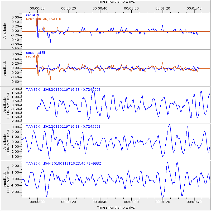
V35K Ketchikan, AK, USA - Earthquake Result Viewer
*The percent match for this event was below the threshold and hence no stack was calculated.
| Earthquake location: |
Gulf Of California |
| Earthquake latitude/longitude: |
26.7/-111.1 |
| Earthquake time(UTC): |
2018/01/19 (019) 16:17:42 GMT |
| Earthquake Depth: |
10 km |
| Earthquake Magnitude: |
6.3 Mww |
| Earthquake Catalog/Contributor: |
NEIC PDE/us |
|
| Network: |
TA USArray Transportable Network (new EarthScope stations) |
| Station: |
V35K Ketchikan, AK, USA |
| Lat/Lon: |
55.33 N/131.62 W |
| Elevation: |
64 m |
|
| Distance: |
32.3 deg |
| Az: |
337.987 deg |
| Baz: |
144.067 deg |
| Ray Param: |
$rayparam |
*The percent match for this event was below the threshold and hence was not used in the summary stack. |
|
| Radial Match: |
62.16964 % |
| Radial Bump: |
400 |
| Transverse Match: |
54.01041 % |
| Transverse Bump: |
400 |
| SOD ConfigId: |
13570011 |
| Insert Time: |
2019-04-29 14:39:11.782 +0000 |
| GWidth: |
2.5 |
| Max Bumps: |
400 |
| Tol: |
0.001 |
|
Signal To Noise
| Channel | StoN | STA | LTA |
| TA:V35K: :BHZ:20180119T16:23:40.724999Z | 2.1347368 | 1.3196766E-6 | 6.1819173E-7 |
| TA:V35K: :BHN:20180119T16:23:40.724999Z | 1.9985601 | 1.0917333E-6 | 5.462599E-7 |
| TA:V35K: :BHE:20180119T16:23:40.724999Z | 1.7758034 | 1.0523884E-6 | 5.9262663E-7 |
| Arrivals |
| Ps | |
| PpPs | |
| PsPs/PpSs | |


