You are here: Home > Network List > CI - Caltech Regional Seismic Network Stations List
> Station MPM Manuel Prospect Mine, California, USA > Earthquake Result Viewer
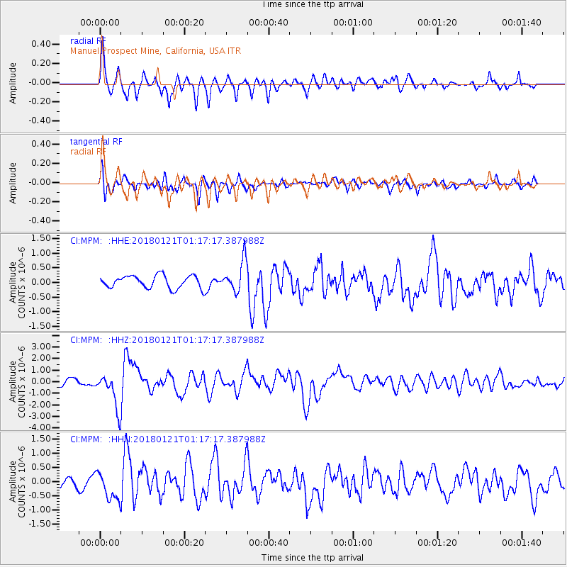
MPM Manuel Prospect Mine, California, USA - Earthquake Result Viewer
*The percent match for this event was below the threshold and hence no stack was calculated.
| Earthquake location: |
Northern Chile |
| Earthquake latitude/longitude: |
-18.9/-69.6 |
| Earthquake time(UTC): |
2018/01/21 (021) 01:06:42 GMT |
| Earthquake Depth: |
111 km |
| Earthquake Magnitude: |
6.3 Mww |
| Earthquake Catalog/Contributor: |
NEIC PDE/us |
|
| Network: |
CI Caltech Regional Seismic Network |
| Station: |
MPM Manuel Prospect Mine, California, USA |
| Lat/Lon: |
36.06 N/117.49 W |
| Elevation: |
185 m |
|
| Distance: |
71.0 deg |
| Az: |
320.528 deg |
| Baz: |
132.029 deg |
| Ray Param: |
$rayparam |
*The percent match for this event was below the threshold and hence was not used in the summary stack. |
|
| Radial Match: |
84.82577 % |
| Radial Bump: |
400 |
| Transverse Match: |
75.958145 % |
| Transverse Bump: |
400 |
| SOD ConfigId: |
13570011 |
| Insert Time: |
2019-04-29 14:41:42.683 +0000 |
| GWidth: |
2.5 |
| Max Bumps: |
400 |
| Tol: |
0.001 |
|
Signal To Noise
| Channel | StoN | STA | LTA |
| CI:MPM: :HHZ:20180121T01:17:17.387988Z | 5.397178 | 1.6575867E-6 | 3.0712098E-7 |
| CI:MPM: :HHN:20180121T01:17:17.387988Z | 2.2036908 | 4.648779E-7 | 2.1095424E-7 |
| CI:MPM: :HHE:20180121T01:17:17.387988Z | 2.2935016 | 4.806617E-7 | 2.0957546E-7 |
| Arrivals |
| Ps | |
| PpPs | |
| PsPs/PpSs | |


