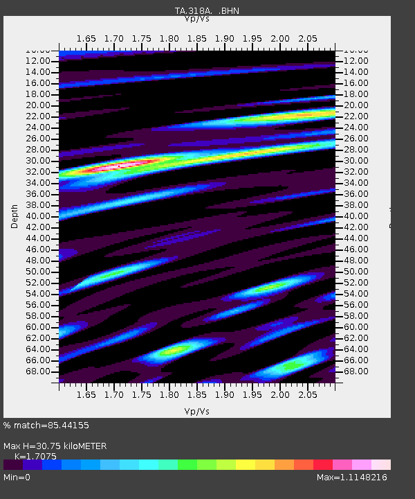
318A Bisbee, AZ, USA - Earthquake Result Viewer
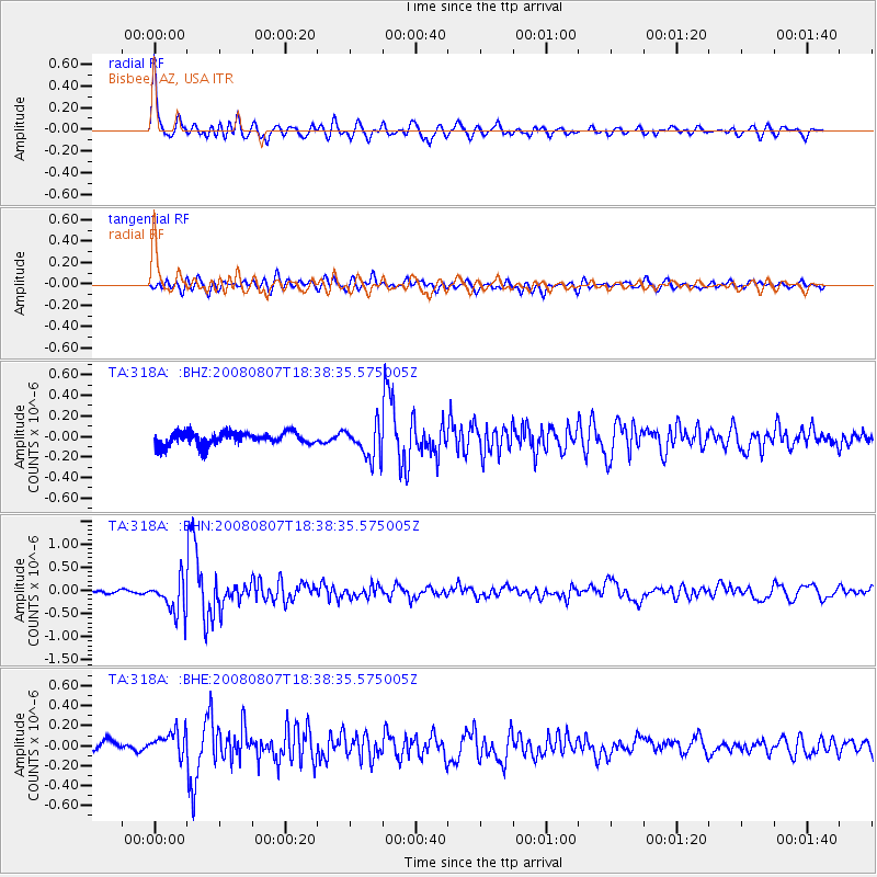
Earthquake location: Andreanof Islands, Aleutian Is.
Earthquake latitude/longitude: 52.2/-175.7
Earthquake time(UTC): 2008/08/07 (220) 18:30:03 GMT
Earthquake Depth: 12 km
Earthquake Magnitude: 5.6 MB, 5.5 MS, 5.8 MW, 5.8 MW
Earthquake Catalog/Contributor: WHDF/NEIC
Network: TA USArray Transportable Network (new EarthScope stations)
Station: 318A Bisbee, AZ, USA
Lat/Lon: 31.44 N/109.99 W
Elevation: 1576 m
Distance: 51.3 deg
Az: 86.919 deg
Baz: 314.013 deg
Ray Param: 0.06752597
Estimated Moho Depth: 30.75 km
Estimated Crust Vp/Vs: 1.71
Assumed Crust Vp: 6.182 km/s
Estimated Crust Vs: 3.621 km/s
Estimated Crust Poisson's Ratio: 0.24
Radial Match: 85.44155 %
Radial Bump: 400
Transverse Match: 76.89572 %
Transverse Bump: 400
SOD ConfigId: 2504
Insert Time: 2010-03-06 08:08:14.809 +0000
GWidth: 2.5
Max Bumps: 400
Tol: 0.001

Signal To Noise

ChannelStoNSTALTA
TA:318A: :BHN:20080807T18:38:35.575005Z8.6429883.7894813E-74.3844576E-8
TA:318A: :BHE:20080807T18:38:35.575005Z2.6609831.3415755E-75.041653E-8
TA:318A: :BHZ:20080807T18:38:35.575005Z2.65909171.6204734E-76.094086E-8
Arrivals
Ps3.7 SECOND
PpPs13 SECOND
PsPs/PpSs16 SECOND