You are here: Home > Network List > TA - USArray Transportable Network (new EarthScope stations) Stations List
> Station I30M Mount Dempster, Yukon, CAN > Earthquake Result Viewer
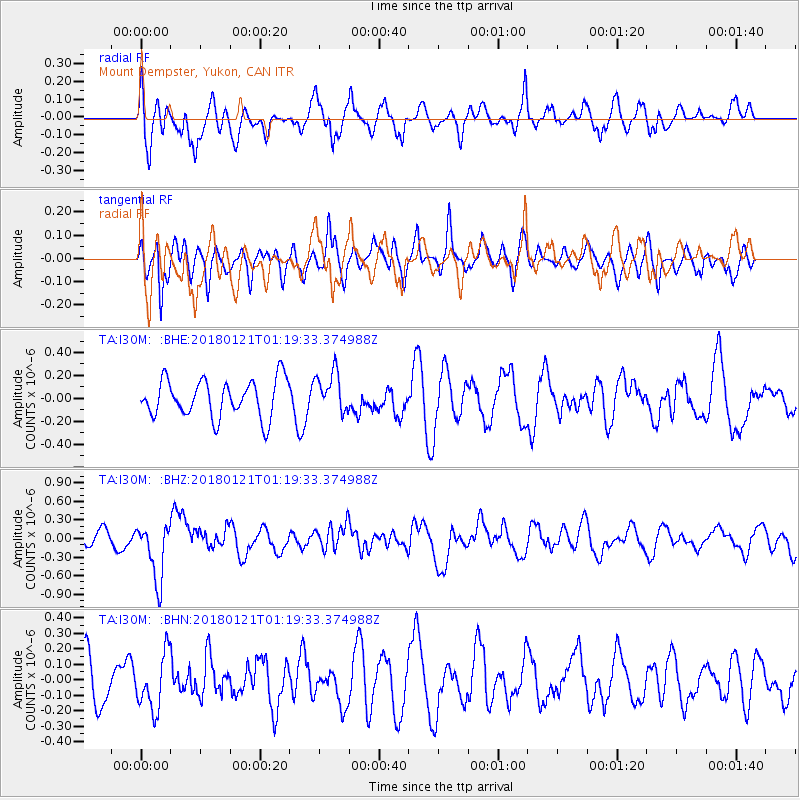
I30M Mount Dempster, Yukon, CAN - Earthquake Result Viewer
*The percent match for this event was below the threshold and hence no stack was calculated.
| Earthquake location: |
Northern Chile |
| Earthquake latitude/longitude: |
-18.9/-69.6 |
| Earthquake time(UTC): |
2018/01/21 (021) 01:06:42 GMT |
| Earthquake Depth: |
111 km |
| Earthquake Magnitude: |
6.3 Mww |
| Earthquake Catalog/Contributor: |
NEIC PDE/us |
|
| Network: |
TA USArray Transportable Network (new EarthScope stations) |
| Station: |
I30M Mount Dempster, Yukon, CAN |
| Lat/Lon: |
65.22 N/136.38 W |
| Elevation: |
1399 m |
|
| Distance: |
97.7 deg |
| Az: |
336.998 deg |
| Baz: |
118.603 deg |
| Ray Param: |
$rayparam |
*The percent match for this event was below the threshold and hence was not used in the summary stack. |
|
| Radial Match: |
50.328434 % |
| Radial Bump: |
400 |
| Transverse Match: |
55.32935 % |
| Transverse Bump: |
400 |
| SOD ConfigId: |
13570011 |
| Insert Time: |
2019-04-29 14:49:15.463 +0000 |
| GWidth: |
2.5 |
| Max Bumps: |
400 |
| Tol: |
0.001 |
|
Signal To Noise
| Channel | StoN | STA | LTA |
| TA:I30M: :BHZ:20180121T01:19:33.374988Z | 3.0729513 | 4.7050563E-7 | 1.5311197E-7 |
| TA:I30M: :BHN:20180121T01:19:33.374988Z | 1.1438661 | 1.8098403E-7 | 1.5822134E-7 |
| TA:I30M: :BHE:20180121T01:19:33.374988Z | 1.0863869 | 1.7726605E-7 | 1.6317028E-7 |
| Arrivals |
| Ps | |
| PpPs | |
| PsPs/PpSs | |


