You are here: Home > Network List > TA - USArray Transportable Network (new EarthScope stations) Stations List
> Station T25A Trinidad, CO, USA > Earthquake Result Viewer
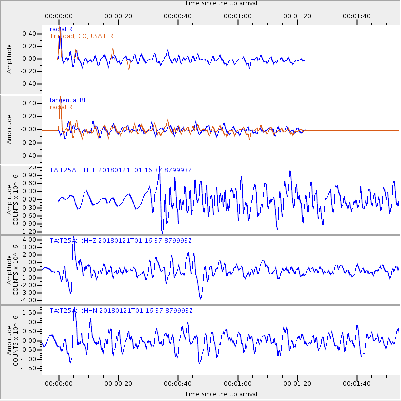
T25A Trinidad, CO, USA - Earthquake Result Viewer
*The percent match for this event was below the threshold and hence no stack was calculated.
| Earthquake location: |
Northern Chile |
| Earthquake latitude/longitude: |
-18.9/-69.6 |
| Earthquake time(UTC): |
2018/01/21 (021) 01:06:42 GMT |
| Earthquake Depth: |
111 km |
| Earthquake Magnitude: |
6.3 Mww |
| Earthquake Catalog/Contributor: |
NEIC PDE/us |
|
| Network: |
TA USArray Transportable Network (new EarthScope stations) |
| Station: |
T25A Trinidad, CO, USA |
| Lat/Lon: |
37.14 N/104.41 W |
| Elevation: |
2017 m |
|
| Distance: |
64.7 deg |
| Az: |
329.7 deg |
| Baz: |
143.289 deg |
| Ray Param: |
$rayparam |
*The percent match for this event was below the threshold and hence was not used in the summary stack. |
|
| Radial Match: |
74.25801 % |
| Radial Bump: |
391 |
| Transverse Match: |
61.705338 % |
| Transverse Bump: |
400 |
| SOD ConfigId: |
13570011 |
| Insert Time: |
2019-04-29 14:49:42.436 +0000 |
| GWidth: |
2.5 |
| Max Bumps: |
400 |
| Tol: |
0.001 |
|
Signal To Noise
| Channel | StoN | STA | LTA |
| TA:T25A: :HHZ:20180121T01:16:37.879993Z | 5.4605474 | 1.6161238E-6 | 2.9596367E-7 |
| TA:T25A: :HHN:20180121T01:16:37.879993Z | 2.0239418 | 5.836213E-7 | 2.883587E-7 |
| TA:T25A: :HHE:20180121T01:16:37.879993Z | 3.3330748 | 4.90098E-7 | 1.4704081E-7 |
| Arrivals |
| Ps | |
| PpPs | |
| PsPs/PpSs | |


