You are here: Home > Network List > UW - Pacific Northwest Regional Seismic Network Stations List
> Station MRBL Marblemount, WA, USA > Earthquake Result Viewer
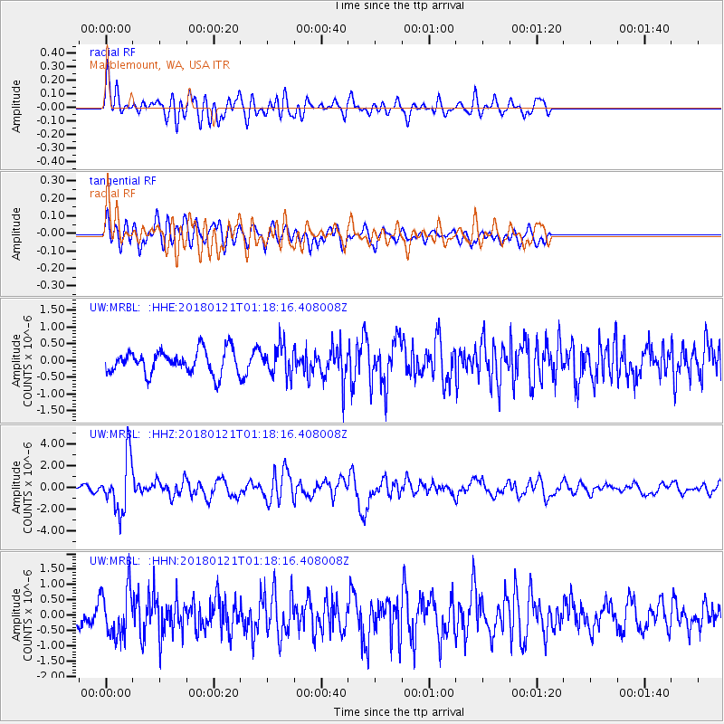
MRBL Marblemount, WA, USA - Earthquake Result Viewer
*The percent match for this event was below the threshold and hence no stack was calculated.
| Earthquake location: |
Northern Chile |
| Earthquake latitude/longitude: |
-18.9/-69.6 |
| Earthquake time(UTC): |
2018/01/21 (021) 01:06:42 GMT |
| Earthquake Depth: |
111 km |
| Earthquake Magnitude: |
6.3 Mww |
| Earthquake Catalog/Contributor: |
NEIC PDE/us |
|
| Network: |
UW Pacific Northwest Regional Seismic Network |
| Station: |
MRBL Marblemount, WA, USA |
| Lat/Lon: |
48.52 N/121.48 W |
| Elevation: |
75 m |
|
| Distance: |
81.5 deg |
| Az: |
328.073 deg |
| Baz: |
131.141 deg |
| Ray Param: |
$rayparam |
*The percent match for this event was below the threshold and hence was not used in the summary stack. |
|
| Radial Match: |
69.37918 % |
| Radial Bump: |
400 |
| Transverse Match: |
54.724644 % |
| Transverse Bump: |
400 |
| SOD ConfigId: |
13570011 |
| Insert Time: |
2019-04-29 14:50:49.500 +0000 |
| GWidth: |
2.5 |
| Max Bumps: |
400 |
| Tol: |
0.001 |
|
Signal To Noise
| Channel | StoN | STA | LTA |
| UW:MRBL: :HHZ:20180121T01:18:16.408008Z | 8.239233 | 2.4424126E-6 | 2.964369E-7 |
| UW:MRBL: :HHN:20180121T01:18:16.408008Z | 2.1743543 | 7.745405E-7 | 3.562163E-7 |
| UW:MRBL: :HHE:20180121T01:18:16.408008Z | 1.2975903 | 4.5231877E-7 | 3.4858368E-7 |
| Arrivals |
| Ps | |
| PpPs | |
| PsPs/PpSs | |


