You are here: Home > Network List > UW - Pacific Northwest Regional Seismic Network Stations List
> Station UMAT Pilot Rock, OR, USA > Earthquake Result Viewer
UMAT Pilot Rock, OR, USA - Earthquake Result Viewer
*The percent match for this event was below the threshold and hence no stack was calculated.
| Earthquake location: |
Northern Chile |
| Earthquake latitude/longitude: |
-18.9/-69.6 |
| Earthquake time(UTC): |
2018/01/21 (021) 01:06:42 GMT |
| Earthquake Depth: |
111 km |
| Earthquake Magnitude: |
6.3 Mww |
| Earthquake Catalog/Contributor: |
NEIC PDE/us |
|
| Network: |
UW Pacific Northwest Regional Seismic Network |
| Station: |
UMAT Pilot Rock, OR, USA |
| Lat/Lon: |
45.29 N/118.96 W |
| Elevation: |
1318 m |
|
| Distance: |
78.0 deg |
| Az: |
326.809 deg |
| Baz: |
132.755 deg |
| Ray Param: |
$rayparam |
*The percent match for this event was below the threshold and hence was not used in the summary stack. |
|
| Radial Match: |
76.70638 % |
| Radial Bump: |
400 |
| Transverse Match: |
49.73189 % |
| Transverse Bump: |
394 |
| SOD ConfigId: |
13570011 |
| Insert Time: |
2019-04-29 14:51:00.494 +0000 |
| GWidth: |
2.5 |
| Max Bumps: |
400 |
| Tol: |
0.001 |
|
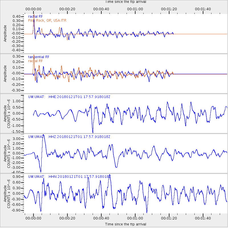
Signal To Noise
| Channel | StoN | STA | LTA |
| UW:UMAT: :HHZ:20180121T01:17:57.918018Z | 8.143773 | 1.6101285E-6 | 1.9771284E-7 |
| UW:UMAT: :HHN:20180121T01:17:57.918018Z | 1.7982851 | 4.1366096E-7 | 2.3003079E-7 |
| UW:UMAT: :HHE:20180121T01:17:57.918018Z | 1.7020241 | 3.1983043E-7 | 1.8791181E-7 |
| Arrivals |
| Ps | |
| PpPs | |
| PsPs/PpSs | |


