You are here: Home > Network List > TA - USArray Transportable Network (new EarthScope stations) Stations List
> Station 318A Bisbee, AZ, USA > Earthquake Result Viewer
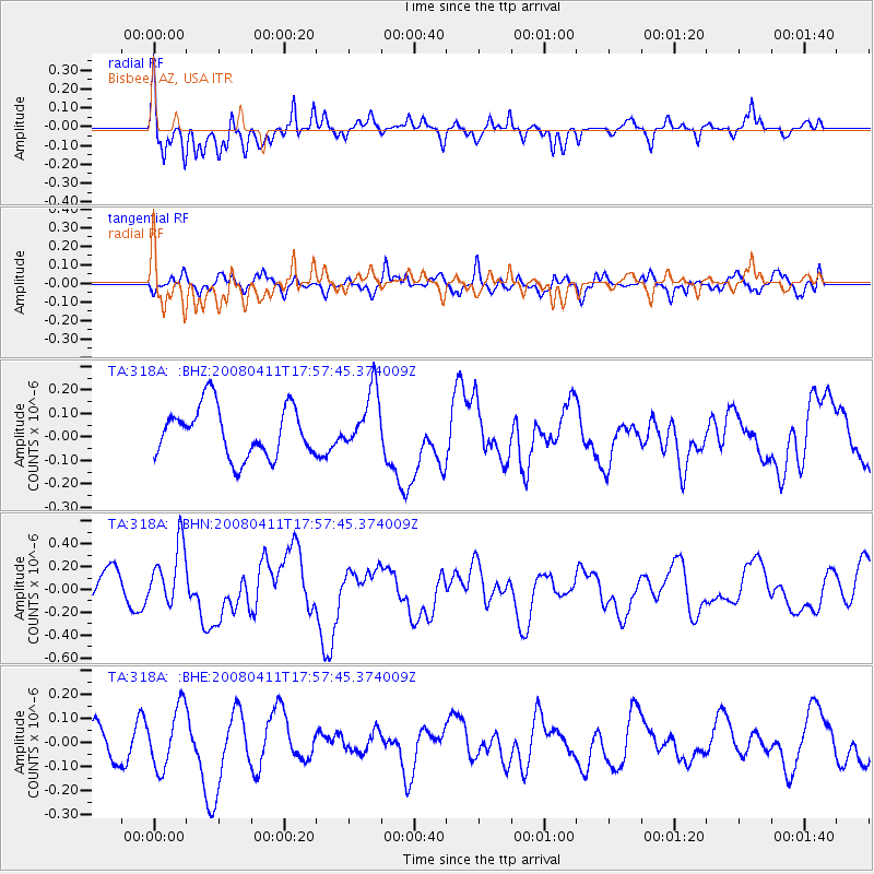
318A Bisbee, AZ, USA - Earthquake Result Viewer
*The percent match for this event was below the threshold and hence no stack was calculated.
| Earthquake location: |
Loyalty Islands |
| Earthquake latitude/longitude: |
-20.4/168.8 |
| Earthquake time(UTC): |
2008/04/11 (102) 17:45:05 GMT |
| Earthquake Depth: |
35 km |
| Earthquake Magnitude: |
5.7 MB, 5.9 MS, 6.0 MW, 6.0 MW |
| Earthquake Catalog/Contributor: |
WHDF/NEIC |
|
| Network: |
TA USArray Transportable Network (new EarthScope stations) |
| Station: |
318A Bisbee, AZ, USA |
| Lat/Lon: |
31.44 N/109.99 W |
| Elevation: |
1576 m |
|
| Distance: |
93.3 deg |
| Az: |
57.784 deg |
| Baz: |
248.198 deg |
| Ray Param: |
$rayparam |
*The percent match for this event was below the threshold and hence was not used in the summary stack. |
|
| Radial Match: |
72.4308 % |
| Radial Bump: |
400 |
| Transverse Match: |
50.595867 % |
| Transverse Bump: |
400 |
| SOD ConfigId: |
2504 |
| Insert Time: |
2010-03-06 08:10:22.650 +0000 |
| GWidth: |
2.5 |
| Max Bumps: |
400 |
| Tol: |
0.001 |
|
Signal To Noise
| Channel | StoN | STA | LTA |
| TA:318A: :BHN:20080411T17:57:45.374009Z | 2.2241287 | 2.7440254E-7 | 1.233753E-7 |
| TA:318A: :BHE:20080411T17:57:45.374009Z | 2.8479776 | 1.2564618E-7 | 4.4117687E-8 |
| TA:318A: :BHZ:20080411T17:57:45.374009Z | 1.1855117 | 1.2583607E-7 | 1.0614493E-7 |
| Arrivals |
| Ps | |
| PpPs | |
| PsPs/PpSs | |


