You are here: Home > Network List > TA - USArray Transportable Network (new EarthScope stations) Stations List
> Station 318A Bisbee, AZ, USA > Earthquake Result Viewer
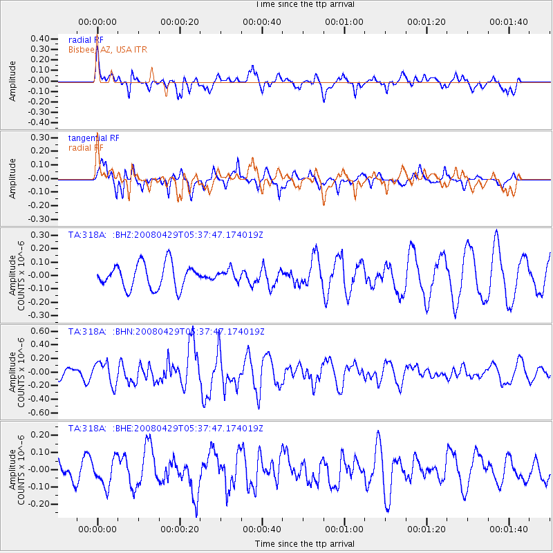
318A Bisbee, AZ, USA - Earthquake Result Viewer
*The percent match for this event was below the threshold and hence no stack was calculated.
| Earthquake location: |
Hokkaido, Japan Region |
| Earthquake latitude/longitude: |
41.5/142.0 |
| Earthquake time(UTC): |
2008/04/29 (120) 05:26:04 GMT |
| Earthquake Depth: |
47 km |
| Earthquake Magnitude: |
5.5 MB, 5.2 MS, 5.8 MW, 5.8 MW |
| Earthquake Catalog/Contributor: |
WHDF/NEIC |
|
| Network: |
TA USArray Transportable Network (new EarthScope stations) |
| Station: |
318A Bisbee, AZ, USA |
| Lat/Lon: |
31.44 N/109.99 W |
| Elevation: |
1576 m |
|
| Distance: |
81.7 deg |
| Az: |
55.242 deg |
| Baz: |
313.736 deg |
| Ray Param: |
$rayparam |
*The percent match for this event was below the threshold and hence was not used in the summary stack. |
|
| Radial Match: |
57.799824 % |
| Radial Bump: |
400 |
| Transverse Match: |
87.18475 % |
| Transverse Bump: |
364 |
| SOD ConfigId: |
2504 |
| Insert Time: |
2010-03-06 08:10:27.691 +0000 |
| GWidth: |
2.5 |
| Max Bumps: |
400 |
| Tol: |
0.001 |
|
Signal To Noise
| Channel | StoN | STA | LTA |
| TA:318A: :BHN:20080429T05:37:47.174019Z | 2.6528835 | 1.7090926E-7 | 6.442396E-8 |
| TA:318A: :BHE:20080429T05:37:47.174019Z | 1.3853731 | 8.058016E-8 | 5.8164947E-8 |
| TA:318A: :BHZ:20080429T05:37:47.174019Z | 0.46795467 | 4.264061E-8 | 9.1121244E-8 |
| Arrivals |
| Ps | |
| PpPs | |
| PsPs/PpSs | |


