You are here: Home > Network List > IW - Intermountain West Stations List
> Station DLMT Dillon, Montana, USA > Earthquake Result Viewer
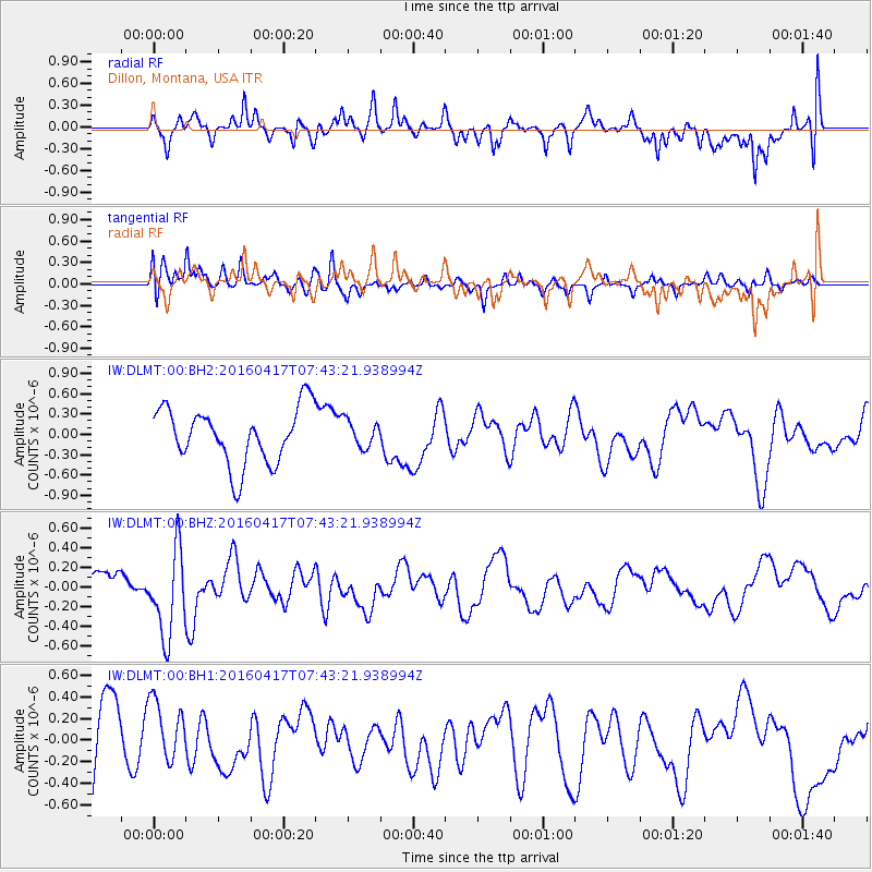
DLMT Dillon, Montana, USA - Earthquake Result Viewer
*The percent match for this event was below the threshold and hence no stack was calculated.
| Earthquake location: |
Tonga Islands Region |
| Earthquake latitude/longitude: |
-23.6/-174.3 |
| Earthquake time(UTC): |
2016/04/17 (108) 07:31:03 GMT |
| Earthquake Depth: |
35 km |
| Earthquake Magnitude: |
5.8 MB |
| Earthquake Catalog/Contributor: |
NEIC PDE/NEIC COMCAT |
|
| Network: |
IW Intermountain West |
| Station: |
DLMT Dillon, Montana, USA |
| Lat/Lon: |
45.36 N/112.60 W |
| Elevation: |
1569 m |
|
| Distance: |
88.6 deg |
| Az: |
38.396 deg |
| Baz: |
233.916 deg |
| Ray Param: |
$rayparam |
*The percent match for this event was below the threshold and hence was not used in the summary stack. |
|
| Radial Match: |
62.37003 % |
| Radial Bump: |
400 |
| Transverse Match: |
63.022068 % |
| Transverse Bump: |
400 |
| SOD ConfigId: |
1475611 |
| Insert Time: |
2016-05-01 07:38:58.299 +0000 |
| GWidth: |
2.5 |
| Max Bumps: |
400 |
| Tol: |
0.001 |
|
Signal To Noise
| Channel | StoN | STA | LTA |
| IW:DLMT:00:BHZ:20160417T07:43:21.938994Z | 3.1697452 | 4.3970687E-7 | 1.3871994E-7 |
| IW:DLMT:00:BH1:20160417T07:43:21.938994Z | 0.99140346 | 2.9078862E-7 | 2.9331008E-7 |
| IW:DLMT:00:BH2:20160417T07:43:21.938994Z | 0.4829501 | 1.9974077E-7 | 4.1358467E-7 |
| Arrivals |
| Ps | |
| PpPs | |
| PsPs/PpSs | |


