You are here: Home > Network List > IW - Intermountain West Stations List
> Station MOOW Moose Ponds, Wyoming, USA > Earthquake Result Viewer
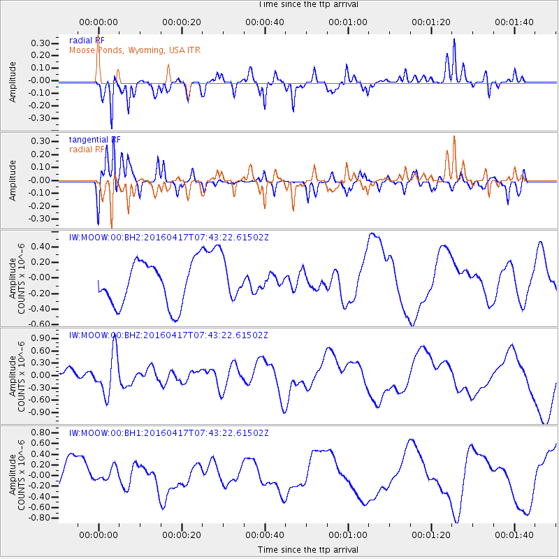
MOOW Moose Ponds, Wyoming, USA - Earthquake Result Viewer
*The percent match for this event was below the threshold and hence no stack was calculated.
| Earthquake location: |
Tonga Islands Region |
| Earthquake latitude/longitude: |
-23.6/-174.3 |
| Earthquake time(UTC): |
2016/04/17 (108) 07:31:03 GMT |
| Earthquake Depth: |
35 km |
| Earthquake Magnitude: |
5.8 MB |
| Earthquake Catalog/Contributor: |
NEIC PDE/NEIC COMCAT |
|
| Network: |
IW Intermountain West |
| Station: |
MOOW Moose Ponds, Wyoming, USA |
| Lat/Lon: |
43.75 N/110.74 W |
| Elevation: |
2128 m |
|
| Distance: |
88.8 deg |
| Az: |
40.478 deg |
| Baz: |
235.258 deg |
| Ray Param: |
$rayparam |
*The percent match for this event was below the threshold and hence was not used in the summary stack. |
|
| Radial Match: |
46.01074 % |
| Radial Bump: |
271 |
| Transverse Match: |
75.47438 % |
| Transverse Bump: |
374 |
| SOD ConfigId: |
1475611 |
| Insert Time: |
2016-05-01 07:39:23.430 +0000 |
| GWidth: |
2.5 |
| Max Bumps: |
400 |
| Tol: |
0.001 |
|
Signal To Noise
| Channel | StoN | STA | LTA |
| IW:MOOW:00:BHZ:20160417T07:43:22.61502Z | 2.430234 | 5.2336E-7 | 2.1535374E-7 |
| IW:MOOW:00:BH1:20160417T07:43:22.61502Z | 0.52791065 | 1.3251866E-7 | 2.510248E-7 |
| IW:MOOW:00:BH2:20160417T07:43:22.61502Z | 0.9106547 | 2.503088E-7 | 2.7486684E-7 |
| Arrivals |
| Ps | |
| PpPs | |
| PsPs/PpSs | |


