You are here: Home > Network List > US - United States National Seismic Network Stations List
> Station BOZ Bozeman, Montana, USA > Earthquake Result Viewer
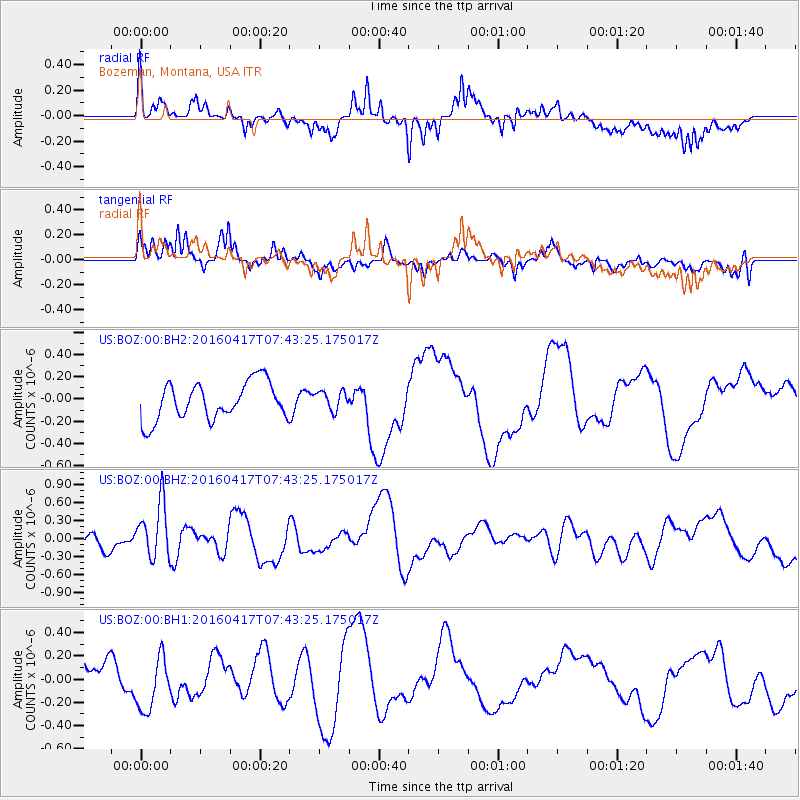
BOZ Bozeman, Montana, USA - Earthquake Result Viewer
*The percent match for this event was below the threshold and hence no stack was calculated.
| Earthquake location: |
Tonga Islands Region |
| Earthquake latitude/longitude: |
-23.6/-174.3 |
| Earthquake time(UTC): |
2016/04/17 (108) 07:31:03 GMT |
| Earthquake Depth: |
35 km |
| Earthquake Magnitude: |
5.8 MB |
| Earthquake Catalog/Contributor: |
NEIC PDE/NEIC COMCAT |
|
| Network: |
US United States National Seismic Network |
| Station: |
BOZ Bozeman, Montana, USA |
| Lat/Lon: |
45.65 N/111.63 W |
| Elevation: |
1589 m |
|
| Distance: |
89.3 deg |
| Az: |
38.562 deg |
| Baz: |
234.606 deg |
| Ray Param: |
$rayparam |
*The percent match for this event was below the threshold and hence was not used in the summary stack. |
|
| Radial Match: |
60.36521 % |
| Radial Bump: |
400 |
| Transverse Match: |
70.65185 % |
| Transverse Bump: |
400 |
| SOD ConfigId: |
1475611 |
| Insert Time: |
2016-05-01 07:40:41.733 +0000 |
| GWidth: |
2.5 |
| Max Bumps: |
400 |
| Tol: |
0.001 |
|
Signal To Noise
| Channel | StoN | STA | LTA |
| US:BOZ:00:BHZ:20160417T07:43:25.175017Z | 4.17425 | 4.6424336E-7 | 1.1121599E-7 |
| US:BOZ:00:BH1:20160417T07:43:25.175017Z | 1.4296099 | 2.3181973E-7 | 1.6215593E-7 |
| US:BOZ:00:BH2:20160417T07:43:25.175017Z | 0.5106165 | 8.586799E-8 | 1.6816533E-7 |
| Arrivals |
| Ps | |
| PpPs | |
| PsPs/PpSs | |


