You are here: Home > Network List > US - United States National Seismic Network Stations List
> Station DUG Dugway, Tooele County, Utah, USA > Earthquake Result Viewer
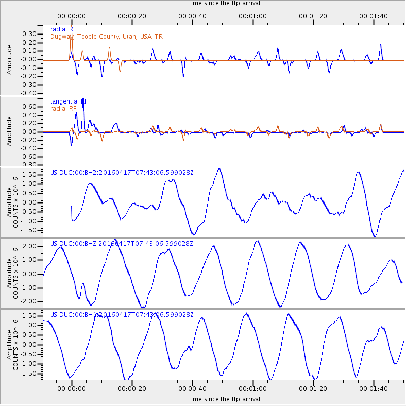
DUG Dugway, Tooele County, Utah, USA - Earthquake Result Viewer
*The percent match for this event was below the threshold and hence no stack was calculated.
| Earthquake location: |
Tonga Islands Region |
| Earthquake latitude/longitude: |
-23.6/-174.3 |
| Earthquake time(UTC): |
2016/04/17 (108) 07:31:03 GMT |
| Earthquake Depth: |
35 km |
| Earthquake Magnitude: |
5.8 MB |
| Earthquake Catalog/Contributor: |
NEIC PDE/NEIC COMCAT |
|
| Network: |
US United States National Seismic Network |
| Station: |
DUG Dugway, Tooele County, Utah, USA |
| Lat/Lon: |
40.19 N/112.81 W |
| Elevation: |
1477 m |
|
| Distance: |
85.5 deg |
| Az: |
42.482 deg |
| Baz: |
233.98 deg |
| Ray Param: |
$rayparam |
*The percent match for this event was below the threshold and hence was not used in the summary stack. |
|
| Radial Match: |
60.41218 % |
| Radial Bump: |
400 |
| Transverse Match: |
92.68466 % |
| Transverse Bump: |
400 |
| SOD ConfigId: |
1475611 |
| Insert Time: |
2016-05-01 07:40:56.624 +0000 |
| GWidth: |
2.5 |
| Max Bumps: |
400 |
| Tol: |
0.001 |
|
Signal To Noise
| Channel | StoN | STA | LTA |
| US:DUG:00:BHZ:20160417T07:43:06.599028Z | 1.058028 | 1.0387879E-6 | 9.818151E-7 |
| US:DUG:00:BH1:20160417T07:43:06.599028Z | 1.6051134 | 1.3902579E-6 | 8.661431E-7 |
| US:DUG:00:BH2:20160417T07:43:06.599028Z | 1.9768524 | 1.0614228E-6 | 5.3692565E-7 |
| Arrivals |
| Ps | |
| PpPs | |
| PsPs/PpSs | |


