You are here: Home > Network List > US - United States National Seismic Network Stations List
> Station EGMT Eagleton, Montana, USA > Earthquake Result Viewer
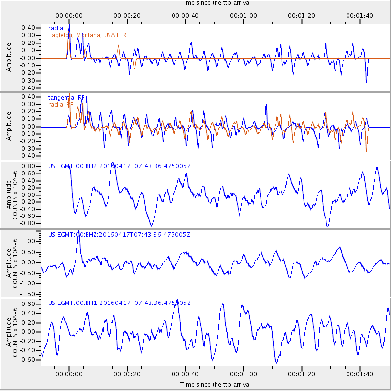
EGMT Eagleton, Montana, USA - Earthquake Result Viewer
*The percent match for this event was below the threshold and hence no stack was calculated.
| Earthquake location: |
Tonga Islands Region |
| Earthquake latitude/longitude: |
-23.6/-174.3 |
| Earthquake time(UTC): |
2016/04/17 (108) 07:31:03 GMT |
| Earthquake Depth: |
35 km |
| Earthquake Magnitude: |
5.8 MB |
| Earthquake Catalog/Contributor: |
NEIC PDE/NEIC COMCAT |
|
| Network: |
US United States National Seismic Network |
| Station: |
EGMT Eagleton, Montana, USA |
| Lat/Lon: |
48.02 N/109.75 W |
| Elevation: |
1055 m |
|
| Distance: |
91.8 deg |
| Az: |
37.34 deg |
| Baz: |
235.982 deg |
| Ray Param: |
$rayparam |
*The percent match for this event was below the threshold and hence was not used in the summary stack. |
|
| Radial Match: |
62.079567 % |
| Radial Bump: |
400 |
| Transverse Match: |
62.89644 % |
| Transverse Bump: |
400 |
| SOD ConfigId: |
1475611 |
| Insert Time: |
2016-05-01 07:41:10.412 +0000 |
| GWidth: |
2.5 |
| Max Bumps: |
400 |
| Tol: |
0.001 |
|
Signal To Noise
| Channel | StoN | STA | LTA |
| US:EGMT:00:BHZ:20160417T07:43:36.475005Z | 2.972916 | 6.478541E-7 | 2.1791875E-7 |
| US:EGMT:00:BH1:20160417T07:43:36.475005Z | 0.2827497 | 8.831569E-8 | 3.123458E-7 |
| US:EGMT:00:BH2:20160417T07:43:36.475005Z | 0.8688917 | 3.1123457E-7 | 3.5819718E-7 |
| Arrivals |
| Ps | |
| PpPs | |
| PsPs/PpSs | |


