You are here: Home > Network List > N4 - Central and EAstern US Network Stations List
> Station P61A Hammonton, NJ, USA > Earthquake Result Viewer
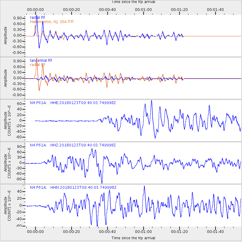
P61A Hammonton, NJ, USA - Earthquake Result Viewer

| Earthquake location: |
Gulf Of Alaska |
| Earthquake latitude/longitude: |
56.0/-149.1 |
| Earthquake time(UTC): |
2018/01/23 (023) 09:31:42 GMT |
| Earthquake Depth: |
25 km |
| Earthquake Magnitude: |
7.9 Mww |
| Earthquake Catalog/Contributor: |
NEIC PDE/us |
|
| Network: |
N4 Central and EAstern US Network |
| Station: |
P61A Hammonton, NJ, USA |
| Lat/Lon: |
39.67 N/74.79 W |
| Elevation: |
22 m |
|
| Distance: |
49.9 deg |
| Az: |
76.111 deg |
| Baz: |
315.11 deg |
| Ray Param: |
0.06834561 |
| Estimated Moho Depth: |
69.75 km |
| Estimated Crust Vp/Vs: |
1.70 |
| Assumed Crust Vp: |
6.287 km/s |
| Estimated Crust Vs: |
3.693 km/s |
| Estimated Crust Poisson's Ratio: |
0.24 |
|
| Radial Match: |
95.031 % |
| Radial Bump: |
400 |
| Transverse Match: |
91.003685 % |
| Transverse Bump: |
400 |
| SOD ConfigId: |
13570011 |
| Insert Time: |
2019-04-29 15:01:00.811 +0000 |
| GWidth: |
2.5 |
| Max Bumps: |
400 |
| Tol: |
0.001 |
|
Signal To Noise
| Channel | StoN | STA | LTA |
| N4:P61A: :HHZ:20180123T09:40:03.749998Z | 5.0624247 | 2.6562184E-6 | 5.2469295E-7 |
| N4:P61A: :HHN:20180123T09:40:03.749998Z | 1.7871274 | 1.1525738E-6 | 6.4493094E-7 |
| N4:P61A: :HHE:20180123T09:40:03.749998Z | 1.3675745 | 8.714814E-7 | 6.3724605E-7 |
| Arrivals |
| Ps | 8.3 SECOND |
| PpPs | 28 SECOND |
| PsPs/PpSs | 37 SECOND |


