You are here: Home > Network List > US - United States National Seismic Network Stations List
> Station WMOK Wichita Mountains, Oklahoma, USA > Earthquake Result Viewer
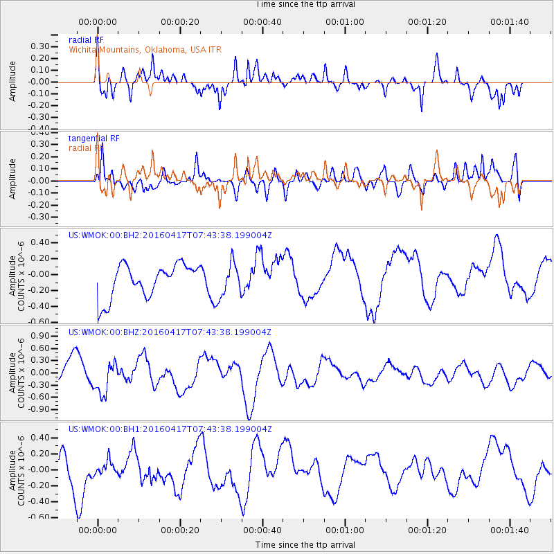
WMOK Wichita Mountains, Oklahoma, USA - Earthquake Result Viewer
*The percent match for this event was below the threshold and hence no stack was calculated.
| Earthquake location: |
Tonga Islands Region |
| Earthquake latitude/longitude: |
-23.6/-174.3 |
| Earthquake time(UTC): |
2016/04/17 (108) 07:31:03 GMT |
| Earthquake Depth: |
35 km |
| Earthquake Magnitude: |
5.8 MB |
| Earthquake Catalog/Contributor: |
NEIC PDE/NEIC COMCAT |
|
| Network: |
US United States National Seismic Network |
| Station: |
WMOK Wichita Mountains, Oklahoma, USA |
| Lat/Lon: |
34.74 N/98.78 W |
| Elevation: |
486 m |
|
| Distance: |
92.1 deg |
| Az: |
52.943 deg |
| Baz: |
242.738 deg |
| Ray Param: |
$rayparam |
*The percent match for this event was below the threshold and hence was not used in the summary stack. |
|
| Radial Match: |
64.47102 % |
| Radial Bump: |
377 |
| Transverse Match: |
57.088276 % |
| Transverse Bump: |
400 |
| SOD ConfigId: |
1475611 |
| Insert Time: |
2016-05-01 07:42:19.888 +0000 |
| GWidth: |
2.5 |
| Max Bumps: |
400 |
| Tol: |
0.001 |
|
Signal To Noise
| Channel | StoN | STA | LTA |
| US:WMOK:00:BHZ:20160417T07:43:38.199004Z | 1.8206333 | 4.0141924E-7 | 2.204833E-7 |
| US:WMOK:00:BH1:20160417T07:43:38.199004Z | 0.4365187 | 8.492346E-8 | 1.9454711E-7 |
| US:WMOK:00:BH2:20160417T07:43:38.199004Z | 0.9948572 | 2.1013742E-7 | 2.1122369E-7 |
| Arrivals |
| Ps | |
| PpPs | |
| PsPs/PpSs | |


