You are here: Home > Network List > TA - USArray Transportable Network (new EarthScope stations) Stations List
> Station T23A Casias Ranch, Antonito, CO, USA > Earthquake Result Viewer
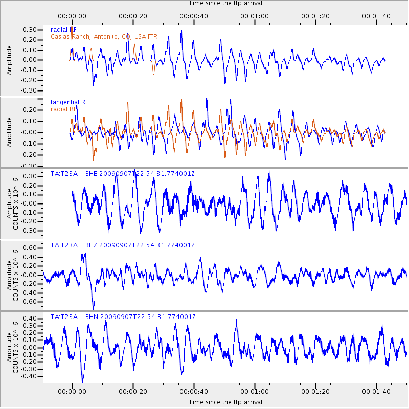
T23A Casias Ranch, Antonito, CO, USA - Earthquake Result Viewer
*The percent match for this event was below the threshold and hence no stack was calculated.
| Earthquake location: |
Northwestern Caucasus |
| Earthquake latitude/longitude: |
42.7/43.4 |
| Earthquake time(UTC): |
2009/09/07 (250) 22:41:37 GMT |
| Earthquake Depth: |
15 km |
| Earthquake Magnitude: |
5.7 MB, 5.8 MS, 6.0 MW, 5.9 MW |
| Earthquake Catalog/Contributor: |
WHDF/NEIC |
|
| Network: |
TA USArray Transportable Network (new EarthScope stations) |
| Station: |
T23A Casias Ranch, Antonito, CO, USA |
| Lat/Lon: |
37.04 N/106.04 W |
| Elevation: |
2429 m |
|
| Distance: |
95.9 deg |
| Az: |
335.885 deg |
| Baz: |
22.125 deg |
| Ray Param: |
$rayparam |
*The percent match for this event was below the threshold and hence was not used in the summary stack. |
|
| Radial Match: |
48.745182 % |
| Radial Bump: |
342 |
| Transverse Match: |
50.919094 % |
| Transverse Bump: |
341 |
| SOD ConfigId: |
2622 |
| Insert Time: |
2010-03-06 08:13:52.775 +0000 |
| GWidth: |
2.5 |
| Max Bumps: |
400 |
| Tol: |
0.001 |
|
Signal To Noise
| Channel | StoN | STA | LTA |
| TA:T23A: :BHZ:20090907T22:54:31.774001Z | 2.0895357 | 2.487337E-7 | 1.19037786E-7 |
| TA:T23A: :BHN:20090907T22:54:31.774001Z | 1.3346372 | 2.0924129E-7 | 1.5677766E-7 |
| TA:T23A: :BHE:20090907T22:54:31.774001Z | 0.70506704 | 1.0950294E-7 | 1.5530856E-7 |
| Arrivals |
| Ps | |
| PpPs | |
| PsPs/PpSs | |


