You are here: Home > Network List > TA - USArray Transportable Network (new EarthScope stations) Stations List
> Station T23A Casias Ranch, Antonito, CO, USA > Earthquake Result Viewer
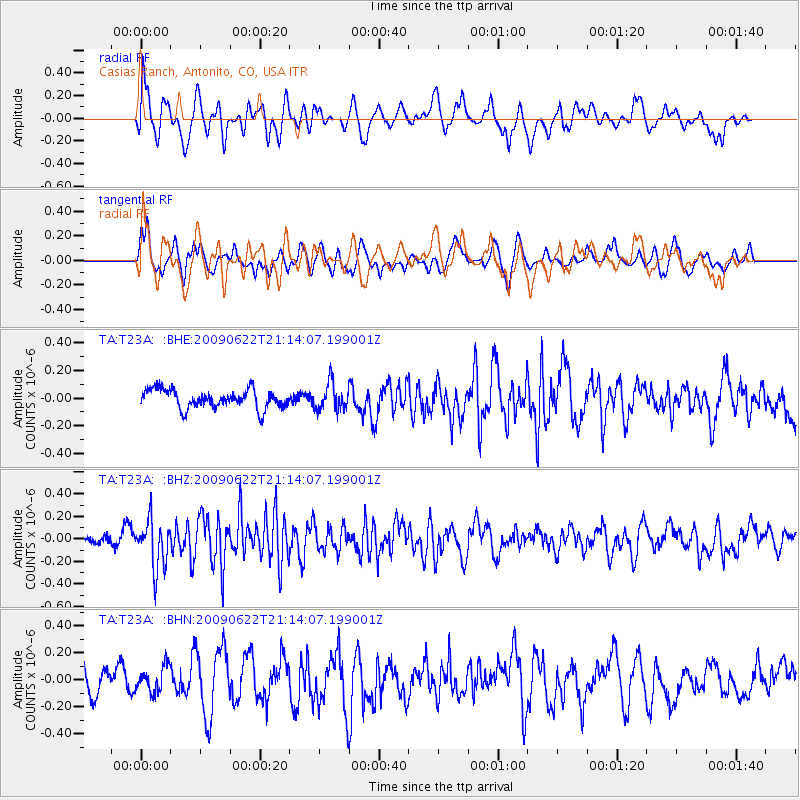
T23A Casias Ranch, Antonito, CO, USA - Earthquake Result Viewer
*The percent match for this event was below the threshold and hence no stack was calculated.
| Earthquake location: |
Andreanof Islands, Aleutian Is. |
| Earthquake latitude/longitude: |
51.3/-178.2 |
| Earthquake time(UTC): |
2009/06/22 (173) 21:05:33 GMT |
| Earthquake Depth: |
29 km |
| Earthquake Magnitude: |
5.5 MB, 5.0 MS, 5.4 MW, 5.4 MW |
| Earthquake Catalog/Contributor: |
WHDF/NEIC |
|
| Network: |
TA USArray Transportable Network (new EarthScope stations) |
| Station: |
T23A Casias Ranch, Antonito, CO, USA |
| Lat/Lon: |
37.04 N/106.04 W |
| Elevation: |
2429 m |
|
| Distance: |
51.7 deg |
| Az: |
76.301 deg |
| Baz: |
310.405 deg |
| Ray Param: |
$rayparam |
*The percent match for this event was below the threshold and hence was not used in the summary stack. |
|
| Radial Match: |
53.800274 % |
| Radial Bump: |
400 |
| Transverse Match: |
50.69718 % |
| Transverse Bump: |
356 |
| SOD ConfigId: |
2648 |
| Insert Time: |
2010-03-06 08:14:36.409 +0000 |
| GWidth: |
2.5 |
| Max Bumps: |
400 |
| Tol: |
0.001 |
|
Signal To Noise
| Channel | StoN | STA | LTA |
| TA:T23A: :BHZ:20090622T21:14:07.199001Z | 3.706478 | 2.1097043E-7 | 5.691938E-8 |
| TA:T23A: :BHN:20090622T21:14:07.199001Z | 0.8523209 | 9.693942E-8 | 1.1373582E-7 |
| TA:T23A: :BHE:20090622T21:14:07.199001Z | 1.4522516 | 9.796526E-8 | 6.7457506E-8 |
| Arrivals |
| Ps | |
| PpPs | |
| PsPs/PpSs | |


