You are here: Home > Network List > TJ - Tajikistan National Seismic Network Stations List
> Station GEZN Gezan, Tajikistan > Earthquake Result Viewer
GEZN Gezan, Tajikistan - Earthquake Result Viewer

| Earthquake location: |
Gulf Of Alaska |
| Earthquake latitude/longitude: |
56.0/-149.1 |
| Earthquake time(UTC): |
2018/01/23 (023) 09:31:42 GMT |
| Earthquake Depth: |
25 km |
| Earthquake Magnitude: |
7.9 Mww |
| Earthquake Catalog/Contributor: |
NEIC PDE/us |
|
| Network: |
TJ Tajikistan National Seismic Network |
| Station: |
GEZN Gezan, Tajikistan |
| Lat/Lon: |
39.28 N/67.72 E |
| Elevation: |
1485 m |
|
| Distance: |
80.0 deg |
| Az: |
331.842 deg |
| Baz: |
19.949 deg |
| Ray Param: |
0.048530843 |
| Estimated Moho Depth: |
22.75 km |
| Estimated Crust Vp/Vs: |
2.10 |
| Assumed Crust Vp: |
6.444 km/s |
| Estimated Crust Vs: |
3.076 km/s |
| Estimated Crust Poisson's Ratio: |
0.35 |
|
| Radial Match: |
94.58675 % |
| Radial Bump: |
400 |
| Transverse Match: |
85.5616 % |
| Transverse Bump: |
400 |
| SOD ConfigId: |
13570011 |
| Insert Time: |
2019-04-29 15:05:00.913 +0000 |
| GWidth: |
2.5 |
| Max Bumps: |
400 |
| Tol: |
0.001 |
|
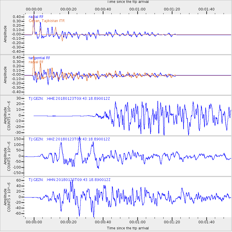
Signal To Noise
| Channel | StoN | STA | LTA |
| TJ:GEZN: :HHZ:20180123T09:43:18.890012Z | 38.264225 | 7.97391E-6 | 2.0839073E-7 |
| TJ:GEZN: :HHN:20180123T09:43:18.890012Z | 16.023626 | 2.8129675E-6 | 1.7555124E-7 |
| TJ:GEZN: :HHE:20180123T09:43:18.890012Z | 2.3029444 | 4.724458E-7 | 2.051486E-7 |
| Arrivals |
| Ps | 4.0 SECOND |
| PpPs | 11 SECOND |
| PsPs/PpSs | 15 SECOND |


