You are here: Home > Network List > CI - Caltech Regional Seismic Network Stations List
> Station BFS Mt Baldy Forest Station > Earthquake Result Viewer
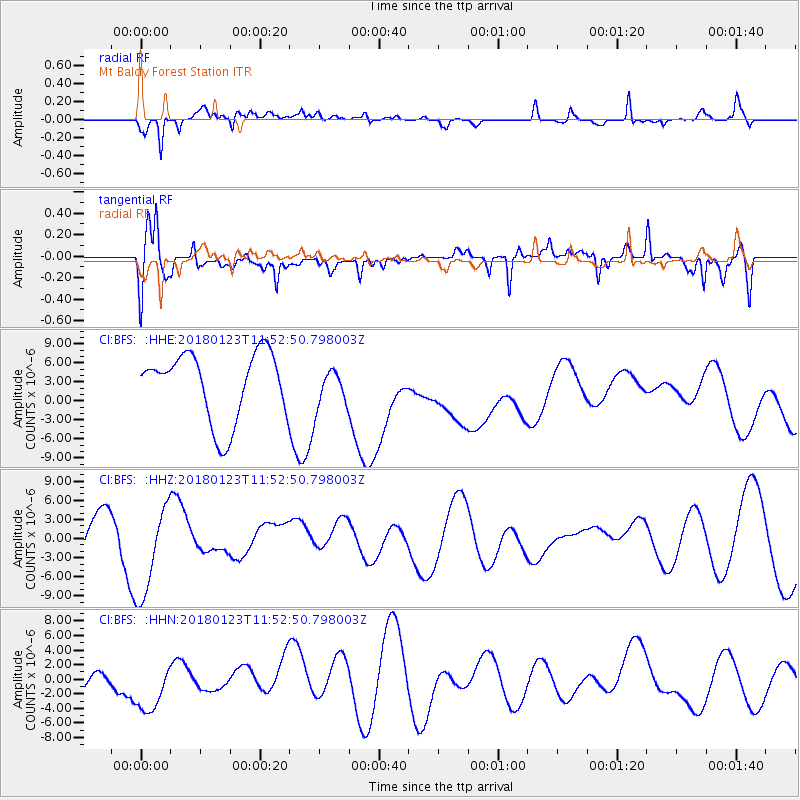
BFS Mt Baldy Forest Station - Earthquake Result Viewer
*The percent match for this event was below the threshold and hence no stack was calculated.
| Earthquake location: |
Gulf Of Alaska |
| Earthquake latitude/longitude: |
56.6/-149.1 |
| Earthquake time(UTC): |
2018/01/23 (023) 11:47:03 GMT |
| Earthquake Depth: |
4.9 km |
| Earthquake Magnitude: |
5.6 mb |
| Earthquake Catalog/Contributor: |
NEIC PDE/ak |
|
| Network: |
CI Caltech Regional Seismic Network |
| Station: |
BFS Mt Baldy Forest Station |
| Lat/Lon: |
34.24 N/117.66 W |
| Elevation: |
1312 m |
|
| Distance: |
31.0 deg |
| Az: |
122.761 deg |
| Baz: |
325.819 deg |
| Ray Param: |
$rayparam |
*The percent match for this event was below the threshold and hence was not used in the summary stack. |
|
| Radial Match: |
49.026184 % |
| Radial Bump: |
400 |
| Transverse Match: |
59.02023 % |
| Transverse Bump: |
400 |
| SOD ConfigId: |
13570011 |
| Insert Time: |
2019-04-29 15:06:56.628 +0000 |
| GWidth: |
2.5 |
| Max Bumps: |
400 |
| Tol: |
0.001 |
|
Signal To Noise
| Channel | StoN | STA | LTA |
| CI:BFS: :HHZ:20180123T11:52:50.798003Z | 1.9701492 | 7.374367E-6 | 3.7430502E-6 |
| CI:BFS: :HHN:20180123T11:52:50.798003Z | 0.86160535 | 3.636008E-6 | 4.2200386E-6 |
| CI:BFS: :HHE:20180123T11:52:50.798003Z | 0.55392474 | 2.9534947E-6 | 5.331942E-6 |
| Arrivals |
| Ps | |
| PpPs | |
| PsPs/PpSs | |


