You are here: Home > Network List > AZ - ANZA Regional Network Stations List
> Station SMER AZ.SMER > Earthquake Result Viewer
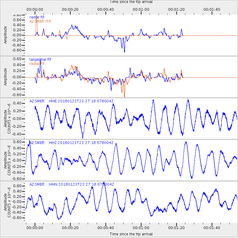
SMER AZ.SMER - Earthquake Result Viewer
*The percent match for this event was below the threshold and hence no stack was calculated.
| Earthquake location: |
Gulf Of Alaska |
| Earthquake latitude/longitude: |
56.6/-148.1 |
| Earthquake time(UTC): |
2018/01/23 (023) 23:21:27 GMT |
| Earthquake Depth: |
12 km |
| Earthquake Magnitude: |
5.3 Mww |
| Earthquake Catalog/Contributor: |
NEIC PDE/ak |
|
| Network: |
AZ ANZA Regional Network |
| Station: |
SMER AZ.SMER |
| Lat/Lon: |
33.46 N/117.17 W |
| Elevation: |
355 m |
|
| Distance: |
31.4 deg |
| Az: |
124.296 deg |
| Baz: |
326.851 deg |
| Ray Param: |
$rayparam |
*The percent match for this event was below the threshold and hence was not used in the summary stack. |
|
| Radial Match: |
45.570663 % |
| Radial Bump: |
400 |
| Transverse Match: |
66.22809 % |
| Transverse Bump: |
400 |
| SOD ConfigId: |
13570011 |
| Insert Time: |
2019-04-29 15:18:11.151 +0000 |
| GWidth: |
2.5 |
| Max Bumps: |
400 |
| Tol: |
0.001 |
|
Signal To Noise
| Channel | StoN | STA | LTA |
| AZ:SMER: :HHZ:20180123T23:27:18.678004Z | 1.0166934 | 2.1173793E-7 | 2.0826134E-7 |
| AZ:SMER: :HHN:20180123T23:27:18.678004Z | 1.0556349 | 1.9446517E-7 | 1.8421633E-7 |
| AZ:SMER: :HHE:20180123T23:27:18.678004Z | 0.91971594 | 1.6493222E-7 | 1.7932952E-7 |
| Arrivals |
| Ps | |
| PpPs | |
| PsPs/PpSs | |


