You are here: Home > Network List > CI - Caltech Regional Seismic Network Stations List
> Station BAR Barrett, Tecate, CA, USA > Earthquake Result Viewer
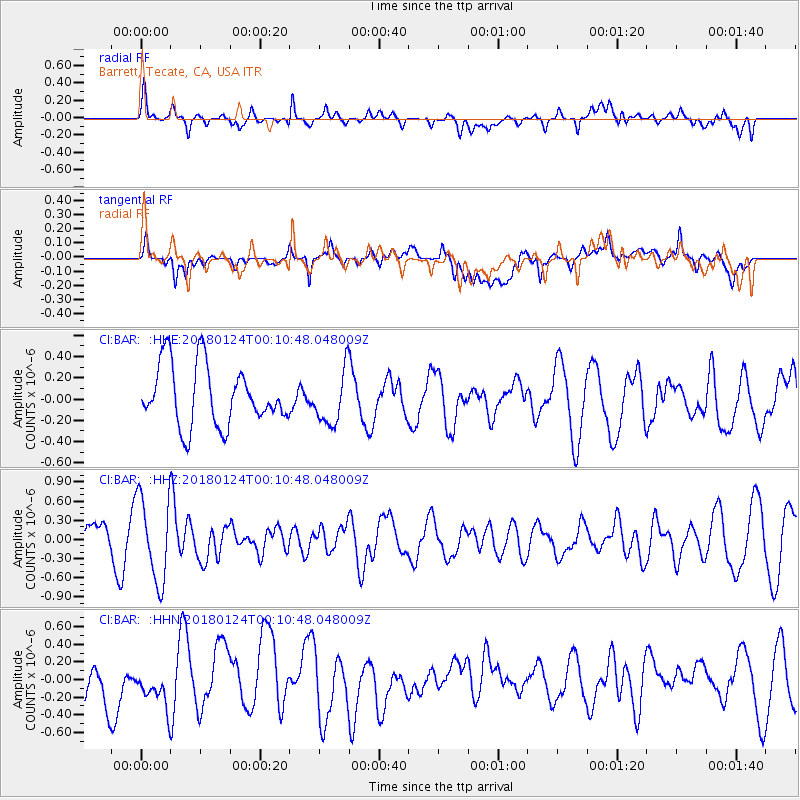
BAR Barrett, Tecate, CA, USA - Earthquake Result Viewer
*The percent match for this event was below the threshold and hence no stack was calculated.
| Earthquake location: |
Gulf Of Alaska |
| Earthquake latitude/longitude: |
56.5/-148.5 |
| Earthquake time(UTC): |
2018/01/24 (024) 00:04:48 GMT |
| Earthquake Depth: |
10 km |
| Earthquake Magnitude: |
5.5 Mww |
| Earthquake Catalog/Contributor: |
NEIC PDE/us |
|
| Network: |
CI Caltech Regional Seismic Network |
| Station: |
BAR Barrett, Tecate, CA, USA |
| Lat/Lon: |
32.68 N/116.67 W |
| Elevation: |
521 m |
|
| Distance: |
32.4 deg |
| Az: |
123.875 deg |
| Baz: |
326.946 deg |
| Ray Param: |
$rayparam |
*The percent match for this event was below the threshold and hence was not used in the summary stack. |
|
| Radial Match: |
59.883476 % |
| Radial Bump: |
400 |
| Transverse Match: |
54.596657 % |
| Transverse Bump: |
400 |
| SOD ConfigId: |
13570011 |
| Insert Time: |
2019-04-29 15:24:28.689 +0000 |
| GWidth: |
2.5 |
| Max Bumps: |
400 |
| Tol: |
0.001 |
|
Signal To Noise
| Channel | StoN | STA | LTA |
| CI:BAR: :HHZ:20180124T00:10:48.048009Z | 2.6459184 | 6.6327823E-7 | 2.5067976E-7 |
| CI:BAR: :HHN:20180124T00:10:48.048009Z | 1.055595 | 2.591529E-7 | 2.4550408E-7 |
| CI:BAR: :HHE:20180124T00:10:48.048009Z | 0.83773416 | 2.3677168E-7 | 2.8263344E-7 |
| Arrivals |
| Ps | |
| PpPs | |
| PsPs/PpSs | |


