You are here: Home > Network List > US - United States National Seismic Network Stations List
> Station HAWA Hanford, Washington, USA > Earthquake Result Viewer
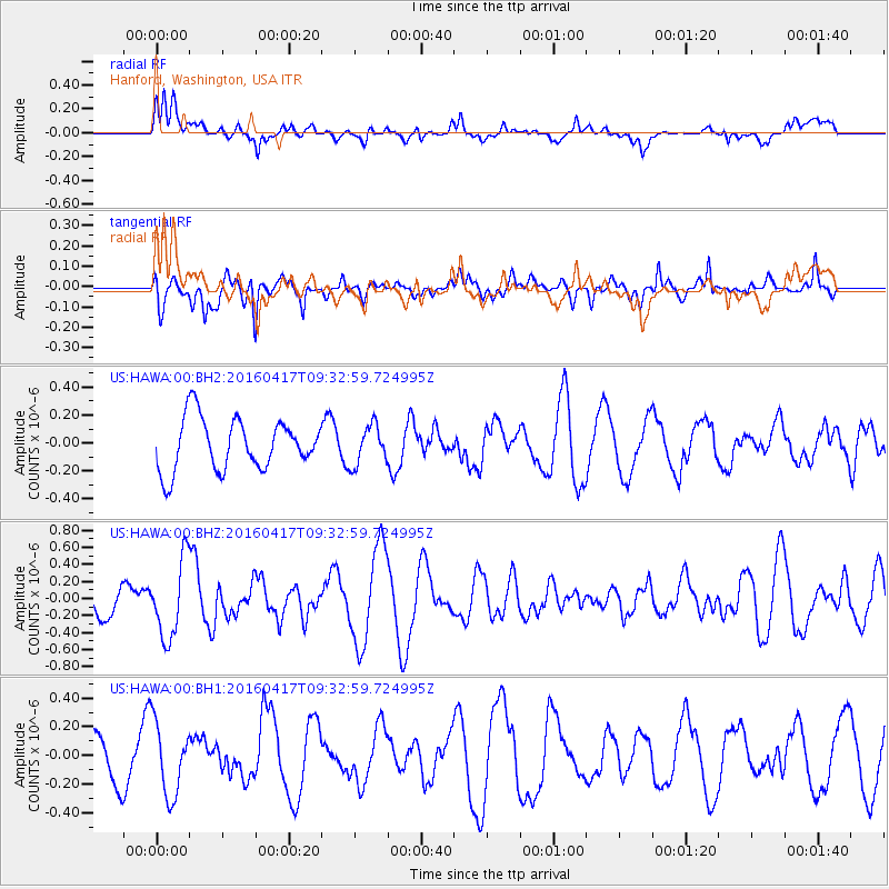
HAWA Hanford, Washington, USA - Earthquake Result Viewer
*The percent match for this event was below the threshold and hence no stack was calculated.
| Earthquake location: |
Near Coast Of Ecuador |
| Earthquake latitude/longitude: |
-0.3/-80.7 |
| Earthquake time(UTC): |
2016/04/17 (108) 09:23:40 GMT |
| Earthquake Depth: |
10 km |
| Earthquake Magnitude: |
5.5 MB |
| Earthquake Catalog/Contributor: |
NEIC PDE/NEIC COMCAT |
|
| Network: |
US United States National Seismic Network |
| Station: |
HAWA Hanford, Washington, USA |
| Lat/Lon: |
46.39 N/119.53 W |
| Elevation: |
364 m |
|
| Distance: |
57.6 deg |
| Az: |
329.072 deg |
| Baz: |
132.05 deg |
| Ray Param: |
$rayparam |
*The percent match for this event was below the threshold and hence was not used in the summary stack. |
|
| Radial Match: |
58.298973 % |
| Radial Bump: |
400 |
| Transverse Match: |
75.19214 % |
| Transverse Bump: |
400 |
| SOD ConfigId: |
1475611 |
| Insert Time: |
2016-05-01 09:30:12.553 +0000 |
| GWidth: |
2.5 |
| Max Bumps: |
400 |
| Tol: |
0.001 |
|
Signal To Noise
| Channel | StoN | STA | LTA |
| US:HAWA:00:BHZ:20160417T09:32:59.724995Z | 2.4273548 | 4.5081245E-7 | 1.8572169E-7 |
| US:HAWA:00:BH1:20160417T09:32:59.724995Z | 1.7015283 | 2.5486725E-7 | 1.4978725E-7 |
| US:HAWA:00:BH2:20160417T09:32:59.724995Z | 0.7600489 | 1.4008953E-7 | 1.8431646E-7 |
| Arrivals |
| Ps | |
| PpPs | |
| PsPs/PpSs | |


