You are here: Home > Network List > TA - USArray Transportable Network (new EarthScope stations) Stations List
> Station S25A Robets Cordova Ranch, Walsenberg, CO, USA > Earthquake Result Viewer
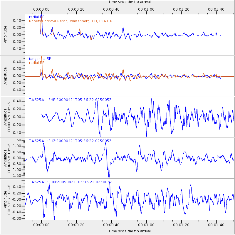
S25A Robets Cordova Ranch, Walsenberg, CO, USA - Earthquake Result Viewer
*The percent match for this event was below the threshold and hence no stack was calculated.
| Earthquake location: |
Kuril Islands |
| Earthquake latitude/longitude: |
50.8/155.0 |
| Earthquake time(UTC): |
2009/04/21 (111) 05:26:11 GMT |
| Earthquake Depth: |
152 km |
| Earthquake Magnitude: |
6.0 MB, 6.2 MW, 6.2 MW |
| Earthquake Catalog/Contributor: |
WHDF/NEIC |
|
| Network: |
TA USArray Transportable Network (new EarthScope stations) |
| Station: |
S25A Robets Cordova Ranch, Walsenberg, CO, USA |
| Lat/Lon: |
37.66 N/104.43 W |
| Elevation: |
1821 m |
|
| Distance: |
67.8 deg |
| Az: |
57.438 deg |
| Baz: |
317.668 deg |
| Ray Param: |
$rayparam |
*The percent match for this event was below the threshold and hence was not used in the summary stack. |
|
| Radial Match: |
76.267654 % |
| Radial Bump: |
400 |
| Transverse Match: |
59.361538 % |
| Transverse Bump: |
400 |
| SOD ConfigId: |
2760 |
| Insert Time: |
2010-03-06 08:18:53.201 +0000 |
| GWidth: |
2.5 |
| Max Bumps: |
400 |
| Tol: |
0.001 |
|
Signal To Noise
| Channel | StoN | STA | LTA |
| TA:S25A: :BHZ:20090421T05:36:22.025005Z | 7.400248 | 6.675327E-7 | 9.02041E-8 |
| TA:S25A: :BHN:20090421T05:36:22.025005Z | 3.4636989 | 2.9476487E-7 | 8.510118E-8 |
| TA:S25A: :BHE:20090421T05:36:22.025005Z | 3.0128 | 2.977742E-7 | 9.883637E-8 |
| Arrivals |
| Ps | |
| PpPs | |
| PsPs/PpSs | |


