You are here: Home > Network List > TA - USArray Transportable Network (new EarthScope stations) Stations List
> Station E20K Nigu River, AK, USA > Earthquake Result Viewer
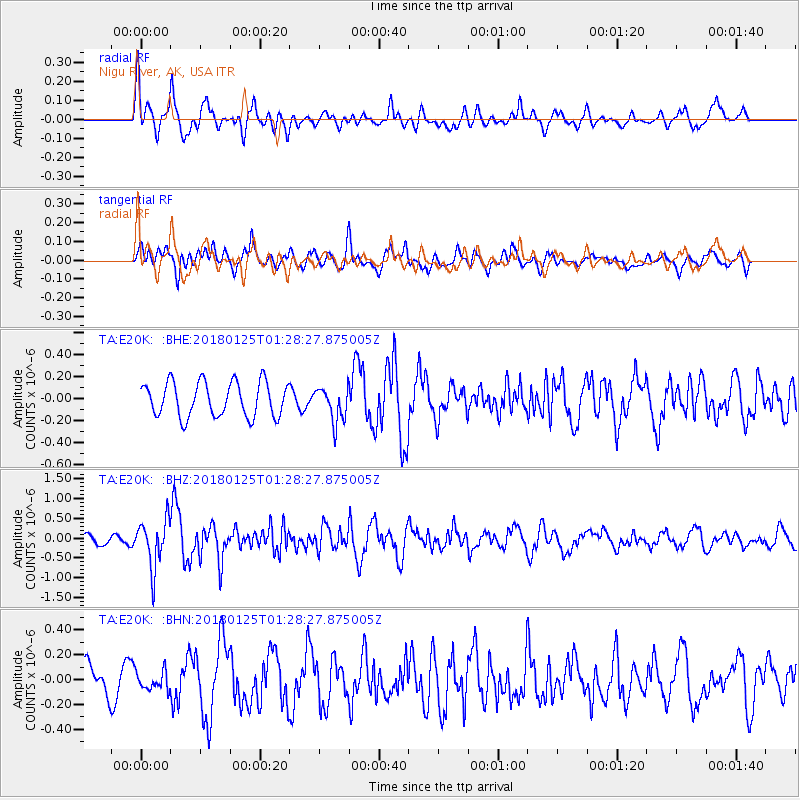
E20K Nigu River, AK, USA - Earthquake Result Viewer
*The percent match for this event was below the threshold and hence no stack was calculated.
| Earthquake location: |
Nicobar Islands, India Region |
| Earthquake latitude/longitude: |
8.3/91.8 |
| Earthquake time(UTC): |
2018/01/25 (025) 01:15:58 GMT |
| Earthquake Depth: |
10 km |
| Earthquake Magnitude: |
5.9 Mww |
| Earthquake Catalog/Contributor: |
NEIC PDE/us |
|
| Network: |
TA USArray Transportable Network (new EarthScope stations) |
| Station: |
E20K Nigu River, AK, USA |
| Lat/Lon: |
68.26 N/156.19 W |
| Elevation: |
866 m |
|
| Distance: |
90.3 deg |
| Az: |
20.206 deg |
| Baz: |
293.437 deg |
| Ray Param: |
$rayparam |
*The percent match for this event was below the threshold and hence was not used in the summary stack. |
|
| Radial Match: |
73.14741 % |
| Radial Bump: |
400 |
| Transverse Match: |
56.168434 % |
| Transverse Bump: |
400 |
| SOD ConfigId: |
13570011 |
| Insert Time: |
2019-04-29 15:46:54.395 +0000 |
| GWidth: |
2.5 |
| Max Bumps: |
400 |
| Tol: |
0.001 |
|
Signal To Noise
| Channel | StoN | STA | LTA |
| TA:E20K: :BHZ:20180125T01:28:27.875005Z | 4.473848 | 6.0524974E-7 | 1.3528617E-7 |
| TA:E20K: :BHN:20180125T01:28:27.875005Z | 0.69893247 | 7.398595E-8 | 1.05855655E-7 |
| TA:E20K: :BHE:20180125T01:28:27.875005Z | 1.009211 | 1.5923763E-7 | 1.5778429E-7 |
| Arrivals |
| Ps | |
| PpPs | |
| PsPs/PpSs | |


