You are here: Home > Network List > TA - USArray Transportable Network (new EarthScope stations) Stations List
> Station I17K Unalakleet, AK, USA > Earthquake Result Viewer
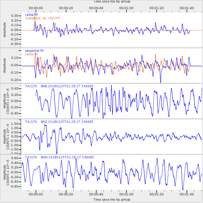
I17K Unalakleet, AK, USA - Earthquake Result Viewer
*The percent match for this event was below the threshold and hence no stack was calculated.
| Earthquake location: |
Nicobar Islands, India Region |
| Earthquake latitude/longitude: |
8.3/91.8 |
| Earthquake time(UTC): |
2018/01/25 (025) 01:15:58 GMT |
| Earthquake Depth: |
10 km |
| Earthquake Magnitude: |
5.9 Mww |
| Earthquake Catalog/Contributor: |
NEIC PDE/us |
|
| Network: |
TA USArray Transportable Network (new EarthScope stations) |
| Station: |
I17K Unalakleet, AK, USA |
| Lat/Lon: |
63.89 N/160.70 W |
| Elevation: |
105 m |
|
| Distance: |
90.2 deg |
| Az: |
24.962 deg |
| Baz: |
289.296 deg |
| Ray Param: |
$rayparam |
*The percent match for this event was below the threshold and hence was not used in the summary stack. |
|
| Radial Match: |
50.07972 % |
| Radial Bump: |
400 |
| Transverse Match: |
59.776306 % |
| Transverse Bump: |
400 |
| SOD ConfigId: |
13570011 |
| Insert Time: |
2019-04-29 15:47:18.470 +0000 |
| GWidth: |
2.5 |
| Max Bumps: |
400 |
| Tol: |
0.001 |
|
Signal To Noise
| Channel | StoN | STA | LTA |
| TA:I17K: :BHZ:20180125T01:28:27.34998Z | 2.1990483 | 4.978371E-7 | 2.2638753E-7 |
| TA:I17K: :BHN:20180125T01:28:27.34998Z | 0.9088457 | 2.2855593E-7 | 2.5147935E-7 |
| TA:I17K: :BHE:20180125T01:28:27.34998Z | 0.9605888 | 2.2922461E-7 | 2.3862927E-7 |
| Arrivals |
| Ps | |
| PpPs | |
| PsPs/PpSs | |


