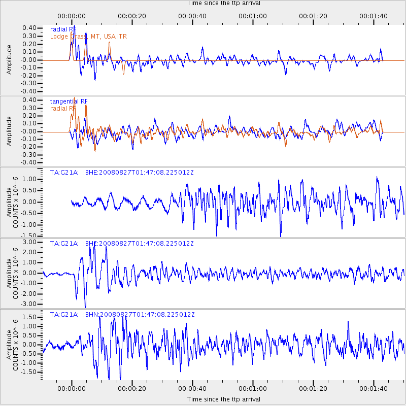
G21A Lodge Grass, MT, USA - Earthquake Result Viewer
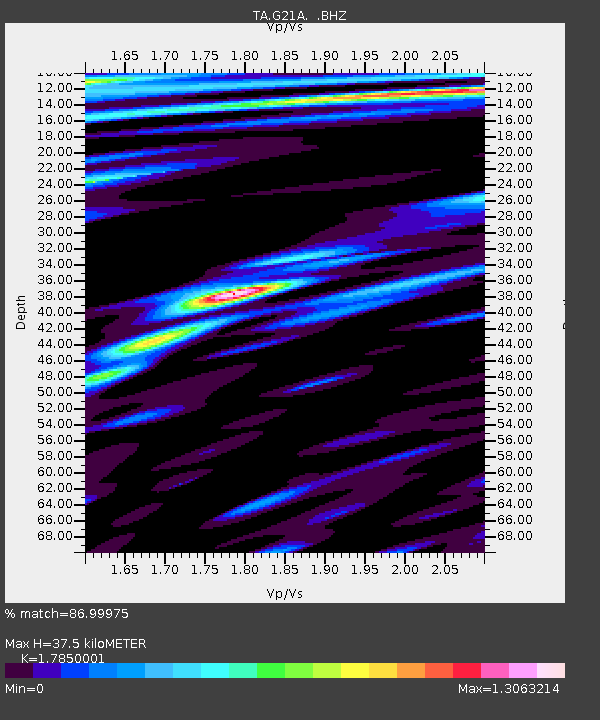
Earthquake location: Lake Baykal Region, Russia
Earthquake latitude/longitude: 51.6/104.2
Earthquake time(UTC): 2008/08/27 (240) 01:35:32 GMT
Earthquake Depth: 16 km
Earthquake Magnitude: 5.8 MB, 6.2 MS, 6.2 MW, 6.2 MW
Earthquake Catalog/Contributor: WHDF/NEIC
Network: TA USArray Transportable Network (new EarthScope stations)
Station: G21A Lodge Grass, MT, USA
Lat/Lon: 45.22 N/107.21 W
Elevation: 1227 m
Distance: 79.8 deg
Az: 21.945 deg
Baz: 340.745 deg
Ray Param: 0.048689418
Estimated Moho Depth: 37.5 km
Estimated Crust Vp/Vs: 1.79
Assumed Crust Vp: 6.178 km/s
Estimated Crust Vs: 3.461 km/s
Estimated Crust Poisson's Ratio: 0.27
Radial Match: 86.99975 %
Radial Bump: 400
Transverse Match: 71.06459 %
Transverse Bump: 400
SOD ConfigId: 2504
Insert Time: 2010-03-06 08:27:54.762 +0000
GWidth: 2.5
Max Bumps: 400
Tol: 0.001

Signal To Noise

ChannelStoNSTALTA
TA:G21A: :BHZ:20080827T01:47:08.225012Z9.3373151.3506548E-61.446513E-7
TA:G21A: :BHN:20080827T01:47:08.225012Z1.62078962.4321136E-71.5005732E-7
TA:G21A: :BHE:20080827T01:47:08.225012Z1.42880422.4498223E-71.7145963E-7
Arrivals
Ps4.9 SECOND
PpPs16 SECOND
PsPs/PpSs21 SECOND