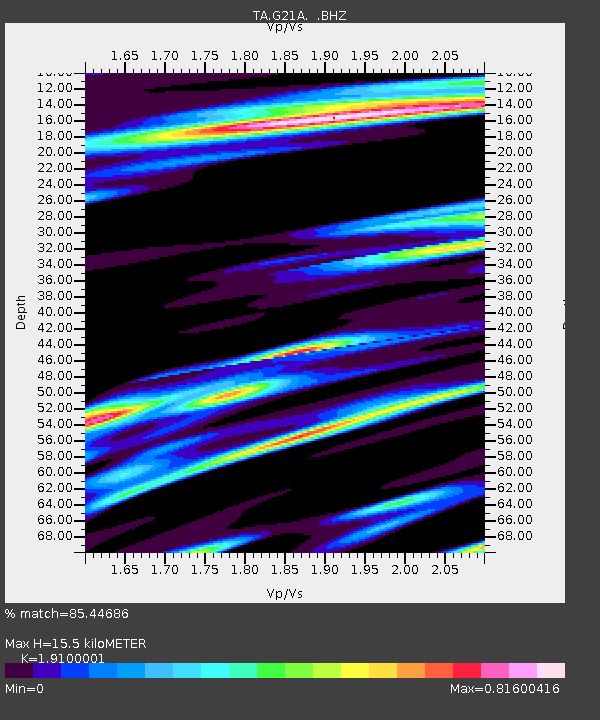
G21A Lodge Grass, MT, USA - Earthquake Result Viewer
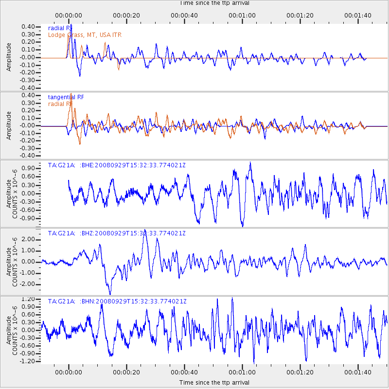
Earthquake location: Kermadec Islands, New Zealand
Earthquake latitude/longitude: -29.8/-177.7
Earthquake time(UTC): 2008/09/29 (273) 15:19:31 GMT
Earthquake Depth: 36 km
Earthquake Magnitude: 6.5 MB, 6.7 MS, 7.0 MW, 7.0 MW
Earthquake Catalog/Contributor: WHDF/NEIC
Network: TA USArray Transportable Network (new EarthScope stations)
Station: G21A Lodge Grass, MT, USA
Lat/Lon: 45.22 N/107.21 W
Elevation: 1227 m
Distance: 98.3 deg
Az: 42.306 deg
Baz: 235.915 deg
Ray Param: 0.039932452
Estimated Moho Depth: 15.5 km
Estimated Crust Vp/Vs: 1.91
Assumed Crust Vp: 6.178 km/s
Estimated Crust Vs: 3.235 km/s
Estimated Crust Poisson's Ratio: 0.31
Radial Match: 85.44686 %
Radial Bump: 400
Transverse Match: 60.41362 %
Transverse Bump: 400
SOD ConfigId: 2560
Insert Time: 2010-03-06 08:28:13.993 +0000
GWidth: 2.5
Max Bumps: 400
Tol: 0.001

Signal To Noise

ChannelStoNSTALTA
TA:G21A: :BHZ:20080929T15:32:33.774021Z3.3899414.639057E-71.3684772E-7
TA:G21A: :BHN:20080929T15:32:33.774021Z0.78022231.5897523E-72.0375631E-7
TA:G21A: :BHE:20080929T15:32:33.774021Z0.864831451.914403E-72.2136139E-7
Arrivals
Ps2.3 SECOND
PpPs7.2 SECOND
PsPs/PpSs9.5 SECOND