You are here: Home > Network List > TA - USArray Transportable Network (new EarthScope stations) Stations List
> Station G21A Lodge Grass, MT, USA > Earthquake Result Viewer
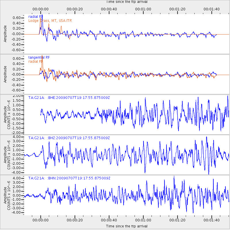
G21A Lodge Grass, MT, USA - Earthquake Result Viewer
*The percent match for this event was below the threshold and hence no stack was calculated.
| Earthquake location: |
Baffin Bay |
| Earthquake latitude/longitude: |
75.4/-72.5 |
| Earthquake time(UTC): |
2009/07/07 (188) 19:11:46 GMT |
| Earthquake Depth: |
19 km |
| Earthquake Magnitude: |
5.9 MB, 5.7 MS, 6.1 MW, 6.0 MW |
| Earthquake Catalog/Contributor: |
WHDF/NEIC |
|
| Network: |
TA USArray Transportable Network (new EarthScope stations) |
| Station: |
G21A Lodge Grass, MT, USA |
| Lat/Lon: |
45.22 N/107.21 W |
| Elevation: |
1227 m |
|
| Distance: |
33.7 deg |
| Az: |
226.563 deg |
| Baz: |
15.158 deg |
| Ray Param: |
$rayparam |
*The percent match for this event was below the threshold and hence was not used in the summary stack. |
|
| Radial Match: |
75.07016 % |
| Radial Bump: |
400 |
| Transverse Match: |
58.367138 % |
| Transverse Bump: |
400 |
| SOD ConfigId: |
2648 |
| Insert Time: |
2010-03-06 08:30:07.934 +0000 |
| GWidth: |
2.5 |
| Max Bumps: |
400 |
| Tol: |
0.001 |
|
Signal To Noise
| Channel | StoN | STA | LTA |
| TA:G21A: :BHZ:20090707T19:17:55.875009Z | 7.5233607 | 1.4081095E-6 | 1.8716496E-7 |
| TA:G21A: :BHN:20090707T19:17:55.875009Z | 2.568455 | 6.9156687E-7 | 2.6925406E-7 |
| TA:G21A: :BHE:20090707T19:17:55.875009Z | 1.1747036 | 3.320663E-7 | 2.8268093E-7 |
| Arrivals |
| Ps | |
| PpPs | |
| PsPs/PpSs | |


