You are here: Home > Network List > TA - USArray Transportable Network (new EarthScope stations) Stations List
> Station L44A Lake County Forest Preserve, Grayslake, IL, USA > Earthquake Result Viewer
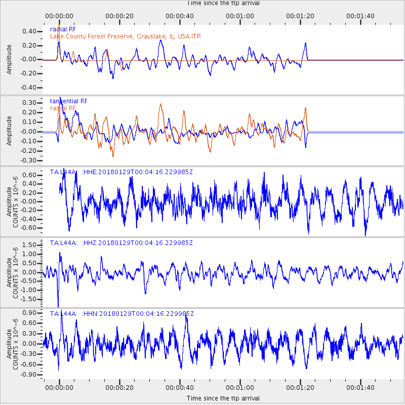
L44A Lake County Forest Preserve, Grayslake, IL, USA - Earthquake Result Viewer
*The percent match for this event was below the threshold and hence no stack was calculated.
| Earthquake location: |
San Juan Province, Argentina |
| Earthquake latitude/longitude: |
-31.3/-68.7 |
| Earthquake time(UTC): |
2018/01/28 (028) 23:53:14 GMT |
| Earthquake Depth: |
88 km |
| Earthquake Magnitude: |
5.4 Mww |
| Earthquake Catalog/Contributor: |
NEIC PDE/us |
|
| Network: |
TA USArray Transportable Network (new EarthScope stations) |
| Station: |
L44A Lake County Forest Preserve, Grayslake, IL, USA |
| Lat/Lon: |
42.18 N/87.91 W |
| Elevation: |
202 m |
|
| Distance: |
75.2 deg |
| Az: |
345.324 deg |
| Baz: |
163.031 deg |
| Ray Param: |
$rayparam |
*The percent match for this event was below the threshold and hence was not used in the summary stack. |
|
| Radial Match: |
59.47707 % |
| Radial Bump: |
400 |
| Transverse Match: |
66.10278 % |
| Transverse Bump: |
400 |
| SOD ConfigId: |
13570011 |
| Insert Time: |
2019-04-29 16:36:00.196 +0000 |
| GWidth: |
2.5 |
| Max Bumps: |
400 |
| Tol: |
0.001 |
|
Signal To Noise
| Channel | StoN | STA | LTA |
| TA:L44A: :HHZ:20180129T00:04:16.229985Z | 2.9981513 | 5.8124556E-7 | 1.9386799E-7 |
| TA:L44A: :HHN:20180129T00:04:16.229985Z | 1.3819102 | 3.5460064E-7 | 2.566018E-7 |
| TA:L44A: :HHE:20180129T00:04:16.229985Z | 0.6292174 | 1.7374416E-7 | 2.761274E-7 |
| Arrivals |
| Ps | |
| PpPs | |
| PsPs/PpSs | |


