You are here: Home > Network List > TA - USArray Transportable Network (new EarthScope stations) Stations List
> Station G21A Lodge Grass, MT, USA > Earthquake Result Viewer
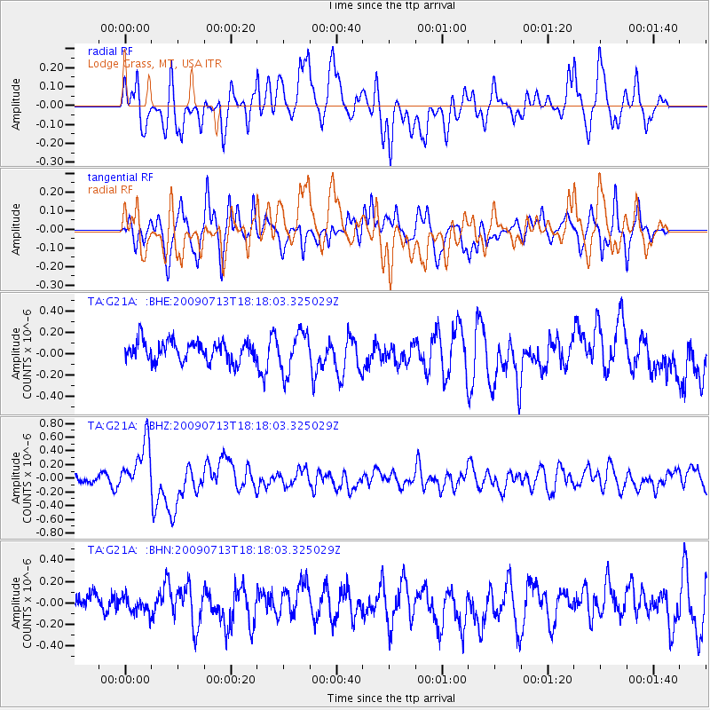
G21A Lodge Grass, MT, USA - Earthquake Result Viewer
*The percent match for this event was below the threshold and hence no stack was calculated.
| Earthquake location: |
Taiwan Region |
| Earthquake latitude/longitude: |
24.1/122.2 |
| Earthquake time(UTC): |
2009/07/13 (194) 18:05:01 GMT |
| Earthquake Depth: |
17 km |
| Earthquake Magnitude: |
6.1 MB, 6.3 MS, 6.3 MW, 6.2 MW |
| Earthquake Catalog/Contributor: |
WHDF/NEIC |
|
| Network: |
TA USArray Transportable Network (new EarthScope stations) |
| Station: |
G21A Lodge Grass, MT, USA |
| Lat/Lon: |
45.22 N/107.21 W |
| Elevation: |
1227 m |
|
| Distance: |
97.7 deg |
| Az: |
32.786 deg |
| Baz: |
315.536 deg |
| Ray Param: |
$rayparam |
*The percent match for this event was below the threshold and hence was not used in the summary stack. |
|
| Radial Match: |
65.14171 % |
| Radial Bump: |
400 |
| Transverse Match: |
63.63034 % |
| Transverse Bump: |
400 |
| SOD ConfigId: |
2648 |
| Insert Time: |
2010-03-06 08:30:12.409 +0000 |
| GWidth: |
2.5 |
| Max Bumps: |
400 |
| Tol: |
0.001 |
|
Signal To Noise
| Channel | StoN | STA | LTA |
| TA:G21A: :BHZ:20090713T18:18:03.325029Z | 2.9921508 | 3.6953415E-7 | 1.2350118E-7 |
| TA:G21A: :BHN:20090713T18:18:03.325029Z | 0.51181585 | 7.088057E-8 | 1.3848842E-7 |
| TA:G21A: :BHE:20090713T18:18:03.325029Z | 2.0033255 | 1.8958252E-7 | 9.463392E-8 |
| Arrivals |
| Ps | |
| PpPs | |
| PsPs/PpSs | |


