You are here: Home > Network List > TA - USArray Transportable Network (new EarthScope stations) Stations List
> Station T25A Trinidad, CO, USA > Earthquake Result Viewer
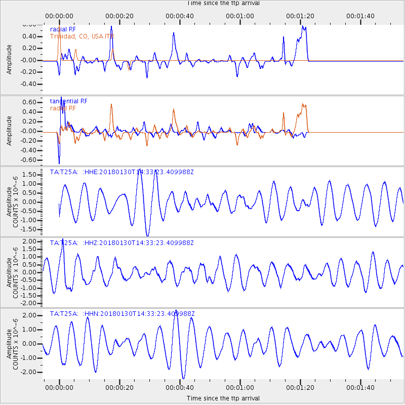
T25A Trinidad, CO, USA - Earthquake Result Viewer
*The percent match for this event was below the threshold and hence no stack was calculated.
| Earthquake location: |
Near Coast Of Peru |
| Earthquake latitude/longitude: |
-15.9/-74.6 |
| Earthquake time(UTC): |
2018/01/30 (030) 14:23:49 GMT |
| Earthquake Depth: |
10 km |
| Earthquake Magnitude: |
5.3 Mww |
| Earthquake Catalog/Contributor: |
NEIC PDE/us |
|
| Network: |
TA USArray Transportable Network (new EarthScope stations) |
| Station: |
T25A Trinidad, CO, USA |
| Lat/Lon: |
37.14 N/104.41 W |
| Elevation: |
2017 m |
|
| Distance: |
59.7 deg |
| Az: |
332.619 deg |
| Baz: |
146.364 deg |
| Ray Param: |
$rayparam |
*The percent match for this event was below the threshold and hence was not used in the summary stack. |
|
| Radial Match: |
55.38213 % |
| Radial Bump: |
296 |
| Transverse Match: |
74.39621 % |
| Transverse Bump: |
400 |
| SOD ConfigId: |
13570011 |
| Insert Time: |
2019-04-29 16:43:46.458 +0000 |
| GWidth: |
2.5 |
| Max Bumps: |
400 |
| Tol: |
0.001 |
|
Signal To Noise
| Channel | StoN | STA | LTA |
| TA:T25A: :HHZ:20180130T14:33:23.409988Z | 2.5354655 | 1.0424965E-6 | 4.111657E-7 |
| TA:T25A: :HHN:20180130T14:33:23.409988Z | 2.0729594 | 1.1227149E-6 | 5.4160006E-7 |
| TA:T25A: :HHE:20180130T14:33:23.409988Z | 1.8870602 | 1.2014276E-6 | 6.366663E-7 |
| Arrivals |
| Ps | |
| PpPs | |
| PsPs/PpSs | |


