You are here: Home > Network List > UW - Pacific Northwest Regional Seismic Network Stations List
> Station UMAT Pilot Rock, OR, USA > Earthquake Result Viewer
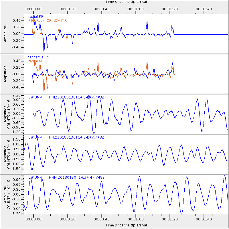
UMAT Pilot Rock, OR, USA - Earthquake Result Viewer
*The percent match for this event was below the threshold and hence no stack was calculated.
| Earthquake location: |
Near Coast Of Peru |
| Earthquake latitude/longitude: |
-15.9/-74.6 |
| Earthquake time(UTC): |
2018/01/30 (030) 14:23:49 GMT |
| Earthquake Depth: |
10 km |
| Earthquake Magnitude: |
5.3 Mww |
| Earthquake Catalog/Contributor: |
NEIC PDE/us |
|
| Network: |
UW Pacific Northwest Regional Seismic Network |
| Station: |
UMAT Pilot Rock, OR, USA |
| Lat/Lon: |
45.29 N/118.96 W |
| Elevation: |
1318 m |
|
| Distance: |
72.9 deg |
| Az: |
328.922 deg |
| Baz: |
135.267 deg |
| Ray Param: |
$rayparam |
*The percent match for this event was below the threshold and hence was not used in the summary stack. |
|
| Radial Match: |
91.04141 % |
| Radial Bump: |
324 |
| Transverse Match: |
39.39438 % |
| Transverse Bump: |
400 |
| SOD ConfigId: |
13570011 |
| Insert Time: |
2019-04-29 16:44:37.190 +0000 |
| GWidth: |
2.5 |
| Max Bumps: |
400 |
| Tol: |
0.001 |
|
Signal To Noise
| Channel | StoN | STA | LTA |
| UW:UMAT: :HHZ:20180130T14:34:47.748Z | 1.954603 | 1.1016141E-6 | 5.6359994E-7 |
| UW:UMAT: :HHN:20180130T14:34:47.748Z | 1.5960555 | 6.686101E-7 | 4.1891406E-7 |
| UW:UMAT: :HHE:20180130T14:34:47.748Z | 1.2713702 | 6.8567766E-7 | 5.3932183E-7 |
| Arrivals |
| Ps | |
| PpPs | |
| PsPs/PpSs | |


