You are here: Home > Network List > CN - Canadian National Seismograph Network Stations List
> Station INK INUVIK, NT > Earthquake Result Viewer
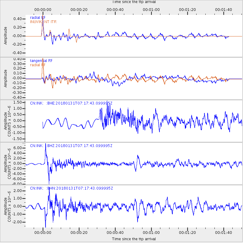
INK INUVIK, NT - Earthquake Result Viewer
*The percent match for this event was below the threshold and hence no stack was calculated.
| Earthquake location: |
Hindu Kush Region, Afghanistan |
| Earthquake latitude/longitude: |
36.5/70.8 |
| Earthquake time(UTC): |
2018/01/31 (031) 07:07:00 GMT |
| Earthquake Depth: |
191 km |
| Earthquake Magnitude: |
6.1 Mww |
| Earthquake Catalog/Contributor: |
NEIC PDE/us |
|
| Network: |
CN Canadian National Seismograph Network |
| Station: |
INK INUVIK, NT |
| Lat/Lon: |
68.31 N/133.53 W |
| Elevation: |
44 m |
|
| Distance: |
73.9 deg |
| Az: |
9.178 deg |
| Baz: |
339.788 deg |
| Ray Param: |
$rayparam |
*The percent match for this event was below the threshold and hence was not used in the summary stack. |
|
| Radial Match: |
79.62197 % |
| Radial Bump: |
400 |
| Transverse Match: |
42.61902 % |
| Transverse Bump: |
400 |
| SOD ConfigId: |
13570011 |
| Insert Time: |
2019-04-29 16:47:46.002 +0000 |
| GWidth: |
2.5 |
| Max Bumps: |
400 |
| Tol: |
0.001 |
|
Signal To Noise
| Channel | StoN | STA | LTA |
| CN:INK: :BHZ:20180131T07:17:43.099995Z | 13.962735 | 3.0091016E-6 | 2.1550947E-7 |
| CN:INK: :BHN:20180131T07:17:43.099995Z | 6.812349 | 1.0074413E-6 | 1.4788458E-7 |
| CN:INK: :BHE:20180131T07:17:43.099995Z | 2.4818337 | 5.949995E-7 | 2.397419E-7 |
| Arrivals |
| Ps | |
| PpPs | |
| PsPs/PpSs | |


