You are here: Home > Network List > TA - USArray Transportable Network (new EarthScope stations) Stations List
> Station H16K Elim, AK, USA > Earthquake Result Viewer
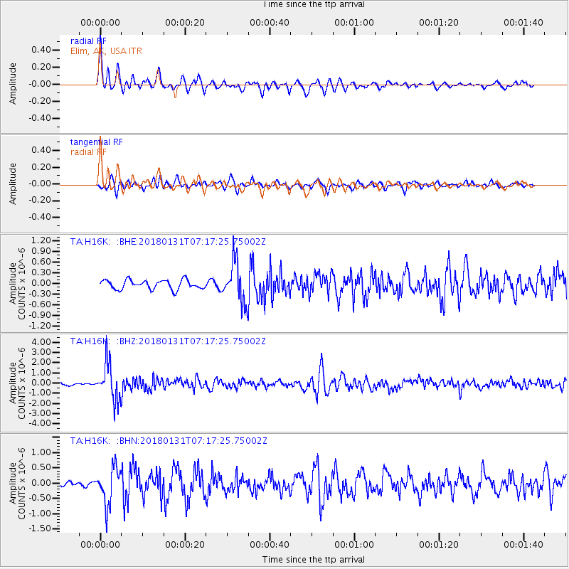
H16K Elim, AK, USA - Earthquake Result Viewer
*The percent match for this event was below the threshold and hence no stack was calculated.
| Earthquake location: |
Hindu Kush Region, Afghanistan |
| Earthquake latitude/longitude: |
36.5/70.8 |
| Earthquake time(UTC): |
2018/01/31 (031) 07:07:00 GMT |
| Earthquake Depth: |
191 km |
| Earthquake Magnitude: |
6.1 Mww |
| Earthquake Catalog/Contributor: |
NEIC PDE/us |
|
| Network: |
TA USArray Transportable Network (new EarthScope stations) |
| Station: |
H16K Elim, AK, USA |
| Lat/Lon: |
64.64 N/162.24 W |
| Elevation: |
216 m |
|
| Distance: |
70.9 deg |
| Az: |
21.357 deg |
| Baz: |
317.082 deg |
| Ray Param: |
$rayparam |
*The percent match for this event was below the threshold and hence was not used in the summary stack. |
|
| Radial Match: |
73.12579 % |
| Radial Bump: |
400 |
| Transverse Match: |
70.34375 % |
| Transverse Bump: |
400 |
| SOD ConfigId: |
13570011 |
| Insert Time: |
2019-04-29 16:51:29.727 +0000 |
| GWidth: |
2.5 |
| Max Bumps: |
400 |
| Tol: |
0.001 |
|
Signal To Noise
| Channel | StoN | STA | LTA |
| TA:H16K: :BHZ:20180131T07:17:25.75002Z | 10.473614 | 1.8121816E-6 | 1.7302352E-7 |
| TA:H16K: :BHN:20180131T07:17:25.75002Z | 7.6047235 | 6.205037E-7 | 8.1594514E-8 |
| TA:H16K: :BHE:20180131T07:17:25.75002Z | 4.537253 | 5.8914304E-7 | 1.2984576E-7 |
| Arrivals |
| Ps | |
| PpPs | |
| PsPs/PpSs | |


