You are here: Home > Network List > TA - USArray Transportable Network (new EarthScope stations) Stations List
> Station L20K Farewell, AK, USA > Earthquake Result Viewer
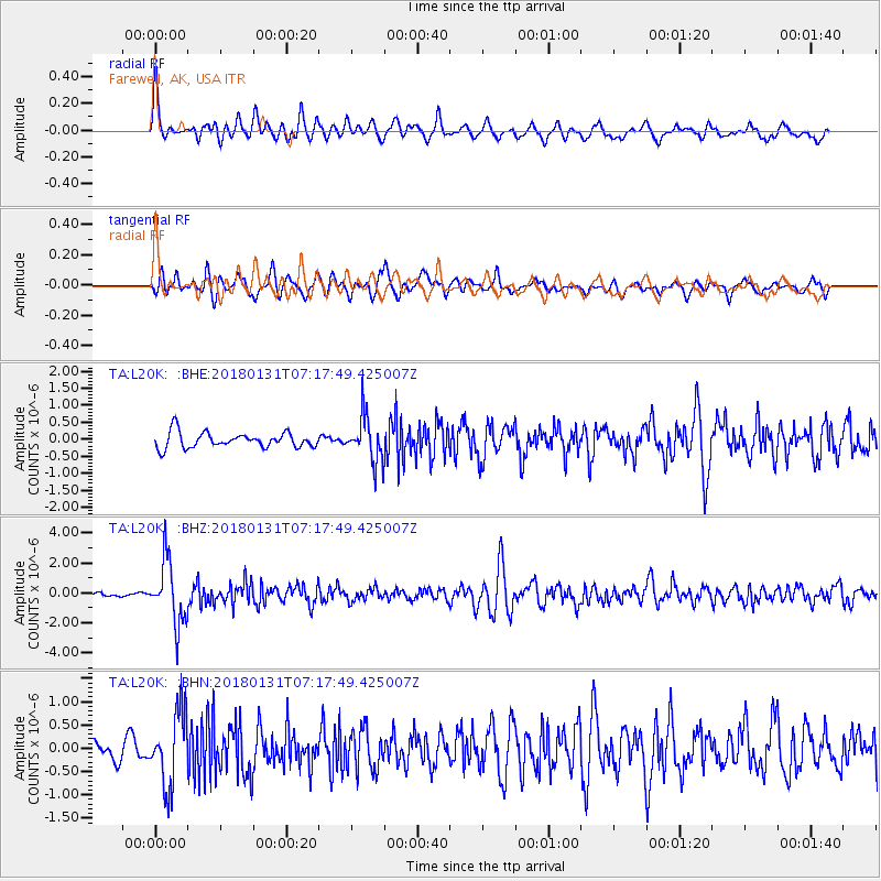
L20K Farewell, AK, USA - Earthquake Result Viewer
*The percent match for this event was below the threshold and hence no stack was calculated.
| Earthquake location: |
Hindu Kush Region, Afghanistan |
| Earthquake latitude/longitude: |
36.5/70.8 |
| Earthquake time(UTC): |
2018/01/31 (031) 07:07:00 GMT |
| Earthquake Depth: |
191 km |
| Earthquake Magnitude: |
6.1 Mww |
| Earthquake Catalog/Contributor: |
NEIC PDE/us |
|
| Network: |
TA USArray Transportable Network (new EarthScope stations) |
| Station: |
L20K Farewell, AK, USA |
| Lat/Lon: |
62.48 N/153.88 W |
| Elevation: |
673 m |
|
| Distance: |
75.0 deg |
| Az: |
19.771 deg |
| Baz: |
324.096 deg |
| Ray Param: |
$rayparam |
*The percent match for this event was below the threshold and hence was not used in the summary stack. |
|
| Radial Match: |
76.47576 % |
| Radial Bump: |
400 |
| Transverse Match: |
73.346016 % |
| Transverse Bump: |
400 |
| SOD ConfigId: |
13570011 |
| Insert Time: |
2019-04-29 16:51:59.590 +0000 |
| GWidth: |
2.5 |
| Max Bumps: |
400 |
| Tol: |
0.001 |
|
Signal To Noise
| Channel | StoN | STA | LTA |
| TA:L20K: :BHZ:20180131T07:17:49.425007Z | 10.514049 | 2.078984E-6 | 1.977339E-7 |
| TA:L20K: :BHN:20180131T07:17:49.425007Z | 2.1653547 | 7.894673E-7 | 3.6459028E-7 |
| TA:L20K: :BHE:20180131T07:17:49.425007Z | 2.8385687 | 6.4477234E-7 | 2.2714698E-7 |
| Arrivals |
| Ps | |
| PpPs | |
| PsPs/PpSs | |


