You are here: Home > Network List > TA - USArray Transportable Network (new EarthScope stations) Stations List
> Station R33M Jennings River, BC, CAN > Earthquake Result Viewer
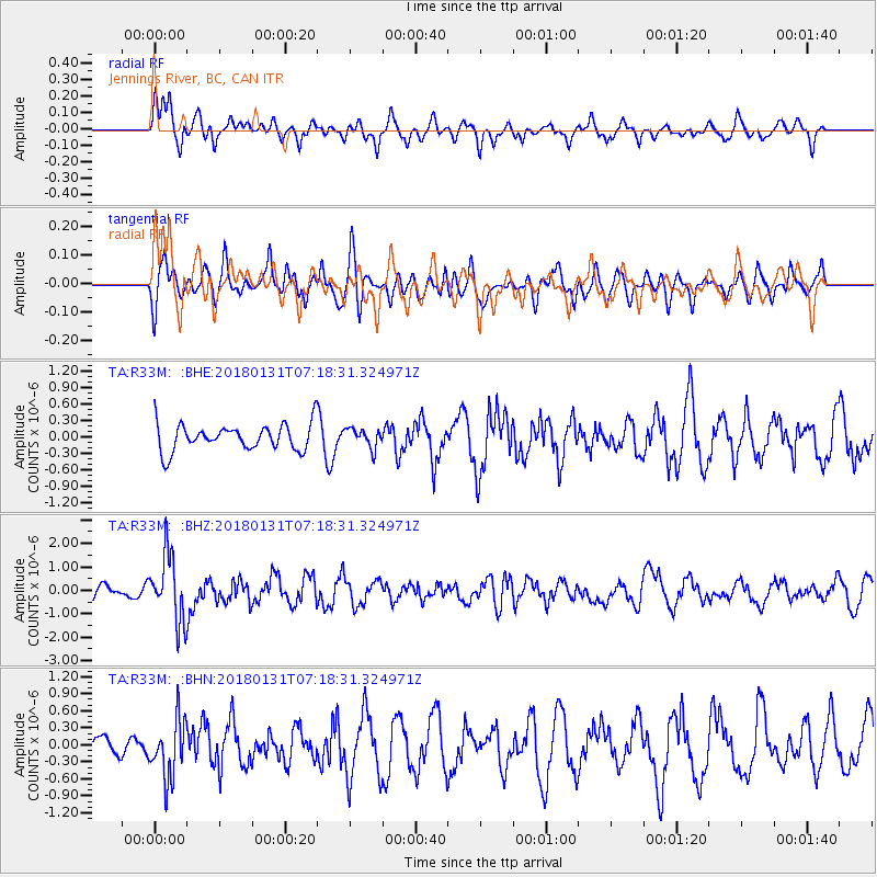
R33M Jennings River, BC, CAN - Earthquake Result Viewer
*The percent match for this event was below the threshold and hence no stack was calculated.
| Earthquake location: |
Hindu Kush Region, Afghanistan |
| Earthquake latitude/longitude: |
36.5/70.8 |
| Earthquake time(UTC): |
2018/01/31 (031) 07:07:00 GMT |
| Earthquake Depth: |
191 km |
| Earthquake Magnitude: |
6.1 Mww |
| Earthquake Catalog/Contributor: |
NEIC PDE/us |
|
| Network: |
TA USArray Transportable Network (new EarthScope stations) |
| Station: |
R33M Jennings River, BC, CAN |
| Lat/Lon: |
59.39 N/130.97 W |
| Elevation: |
1437 m |
|
| Distance: |
82.7 deg |
| Az: |
11.035 deg |
| Baz: |
342.466 deg |
| Ray Param: |
$rayparam |
*The percent match for this event was below the threshold and hence was not used in the summary stack. |
|
| Radial Match: |
63.40621 % |
| Radial Bump: |
396 |
| Transverse Match: |
40.770573 % |
| Transverse Bump: |
400 |
| SOD ConfigId: |
13570011 |
| Insert Time: |
2019-04-29 16:52:45.312 +0000 |
| GWidth: |
2.5 |
| Max Bumps: |
400 |
| Tol: |
0.001 |
|
Signal To Noise
| Channel | StoN | STA | LTA |
| TA:R33M: :BHZ:20180131T07:18:31.324971Z | 3.2758813 | 1.4107101E-6 | 4.306353E-7 |
| TA:R33M: :BHN:20180131T07:18:31.324971Z | 1.4411569 | 5.0915145E-7 | 3.5329356E-7 |
| TA:R33M: :BHE:20180131T07:18:31.324971Z | 0.7403429 | 1.760907E-7 | 2.3785019E-7 |
| Arrivals |
| Ps | |
| PpPs | |
| PsPs/PpSs | |


