You are here: Home > Network List > TA - USArray Transportable Network (new EarthScope stations) Stations List
> Station B18K Kokolik River, AK, USA > Earthquake Result Viewer
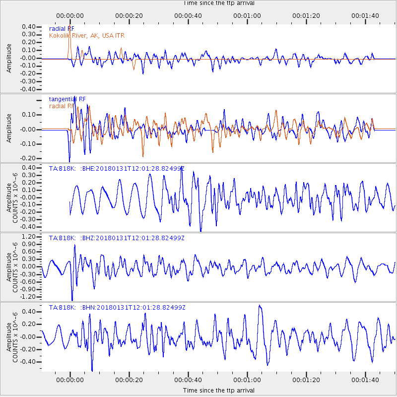
B18K Kokolik River, AK, USA - Earthquake Result Viewer
*The percent match for this event was below the threshold and hence no stack was calculated.
| Earthquake location: |
Eastern New Guinea Reg., P.N.G. |
| Earthquake latitude/longitude: |
-6.9/147.2 |
| Earthquake time(UTC): |
2018/01/31 (031) 11:49:39 GMT |
| Earthquake Depth: |
75 km |
| Earthquake Magnitude: |
5.6 Mww |
| Earthquake Catalog/Contributor: |
NEIC PDE/us |
|
| Network: |
TA USArray Transportable Network (new EarthScope stations) |
| Station: |
B18K Kokolik River, AK, USA |
| Lat/Lon: |
69.36 N/161.80 W |
| Elevation: |
222 m |
|
| Distance: |
83.7 deg |
| Az: |
16.087 deg |
| Baz: |
230.894 deg |
| Ray Param: |
$rayparam |
*The percent match for this event was below the threshold and hence was not used in the summary stack. |
|
| Radial Match: |
41.268845 % |
| Radial Bump: |
400 |
| Transverse Match: |
57.40929 % |
| Transverse Bump: |
400 |
| SOD ConfigId: |
13570011 |
| Insert Time: |
2019-04-29 16:56:47.607 +0000 |
| GWidth: |
2.5 |
| Max Bumps: |
400 |
| Tol: |
0.001 |
|
Signal To Noise
| Channel | StoN | STA | LTA |
| TA:B18K: :BHZ:20180131T12:01:28.82499Z | 2.0802052 | 5.094931E-7 | 2.4492442E-7 |
| TA:B18K: :BHN:20180131T12:01:28.82499Z | 1.022635 | 1.1480859E-7 | 1.1226742E-7 |
| TA:B18K: :BHE:20180131T12:01:28.82499Z | 1.2982535 | 1.7851634E-7 | 1.3750498E-7 |
| Arrivals |
| Ps | |
| PpPs | |
| PsPs/PpSs | |


