You are here: Home > Network List > TA - USArray Transportable Network (new EarthScope stations) Stations List
> Station J26L Joseph Creek, AK, USA > Earthquake Result Viewer
J26L Joseph Creek, AK, USA - Earthquake Result Viewer
*The percent match for this event was below the threshold and hence no stack was calculated.
| Earthquake location: |
Eastern New Guinea Reg., P.N.G. |
| Earthquake latitude/longitude: |
-6.9/147.2 |
| Earthquake time(UTC): |
2018/01/31 (031) 11:49:39 GMT |
| Earthquake Depth: |
75 km |
| Earthquake Magnitude: |
5.6 Mww |
| Earthquake Catalog/Contributor: |
NEIC PDE/us |
|
| Network: |
TA USArray Transportable Network (new EarthScope stations) |
| Station: |
J26L Joseph Creek, AK, USA |
| Lat/Lon: |
64.50 N/143.56 W |
| Elevation: |
1144 m |
|
| Distance: |
87.5 deg |
| Az: |
23.897 deg |
| Baz: |
248.296 deg |
| Ray Param: |
$rayparam |
*The percent match for this event was below the threshold and hence was not used in the summary stack. |
|
| Radial Match: |
56.19608 % |
| Radial Bump: |
400 |
| Transverse Match: |
56.251595 % |
| Transverse Bump: |
400 |
| SOD ConfigId: |
13570011 |
| Insert Time: |
2019-04-29 16:57:32.124 +0000 |
| GWidth: |
2.5 |
| Max Bumps: |
400 |
| Tol: |
0.001 |
|
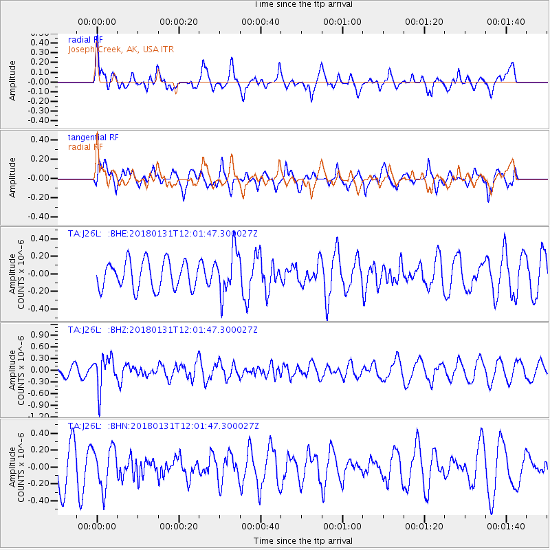
Signal To Noise
| Channel | StoN | STA | LTA |
| TA:J26L: :BHZ:20180131T12:01:47.300027Z | 3.9659083 | 4.244984E-7 | 1.0703687E-7 |
| TA:J26L: :BHN:20180131T12:01:47.300027Z | 1.1442554 | 2.3959294E-7 | 2.0938764E-7 |
| TA:J26L: :BHE:20180131T12:01:47.300027Z | 1.6201015 | 2.553392E-7 | 1.576069E-7 |
| Arrivals |
| Ps | |
| PpPs | |
| PsPs/PpSs | |


