You are here: Home > Network List > CI - Caltech Regional Seismic Network Stations List
> Station DAN Danby, California, USA > Earthquake Result Viewer
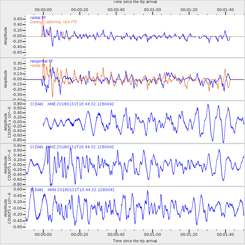
DAN Danby, California, USA - Earthquake Result Viewer
*The percent match for this event was below the threshold and hence no stack was calculated.
| Earthquake location: |
South Of Panama |
| Earthquake latitude/longitude: |
7.2/-79.6 |
| Earthquake time(UTC): |
2018/01/31 (031) 16:37:06 GMT |
| Earthquake Depth: |
10 km |
| Earthquake Magnitude: |
5.7 Mww |
| Earthquake Catalog/Contributor: |
NEIC PDE/us |
|
| Network: |
CI Caltech Regional Seismic Network |
| Station: |
DAN Danby, California, USA |
| Lat/Lon: |
34.64 N/115.38 W |
| Elevation: |
398 m |
|
| Distance: |
42.7 deg |
| Az: |
314.758 deg |
| Baz: |
121.303 deg |
| Ray Param: |
$rayparam |
*The percent match for this event was below the threshold and hence was not used in the summary stack. |
|
| Radial Match: |
55.81702 % |
| Radial Bump: |
400 |
| Transverse Match: |
61.01786 % |
| Transverse Bump: |
400 |
| SOD ConfigId: |
13570011 |
| Insert Time: |
2019-04-29 17:00:25.052 +0000 |
| GWidth: |
2.5 |
| Max Bumps: |
400 |
| Tol: |
0.001 |
|
Signal To Noise
| Channel | StoN | STA | LTA |
| CI:DAN: :HHZ:20180131T16:44:32.128004Z | 2.1065488 | 5.136997E-7 | 2.4385844E-7 |
| CI:DAN: :HHN:20180131T16:44:32.128004Z | 1.2171535 | 3.0741808E-7 | 2.525713E-7 |
| CI:DAN: :HHE:20180131T16:44:32.128004Z | 1.501694 | 2.5949157E-7 | 1.7279923E-7 |
| Arrivals |
| Ps | |
| PpPs | |
| PsPs/PpSs | |


