You are here: Home > Network List > US - United States National Seismic Network Stations List
> Station DGMT Dagmar, Montana, USA > Earthquake Result Viewer
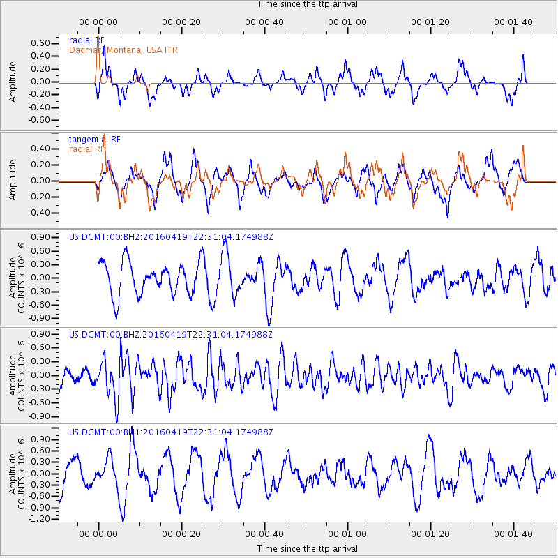
DGMT Dagmar, Montana, USA - Earthquake Result Viewer
*The percent match for this event was below the threshold and hence no stack was calculated.
| Earthquake location: |
Near Coast Of Ecuador |
| Earthquake latitude/longitude: |
0.6/-80.1 |
| Earthquake time(UTC): |
2016/04/19 (110) 22:22:26 GMT |
| Earthquake Depth: |
15 km |
| Earthquake Magnitude: |
5.5 MB |
| Earthquake Catalog/Contributor: |
NEIC PDE/NEIC ALERT |
|
| Network: |
US United States National Seismic Network |
| Station: |
DGMT Dagmar, Montana, USA |
| Lat/Lon: |
48.47 N/104.20 W |
| Elevation: |
0.0 m |
|
| Distance: |
52.1 deg |
| Az: |
339.818 deg |
| Baz: |
148.777 deg |
| Ray Param: |
$rayparam |
*The percent match for this event was below the threshold and hence was not used in the summary stack. |
|
| Radial Match: |
65.315056 % |
| Radial Bump: |
400 |
| Transverse Match: |
68.43882 % |
| Transverse Bump: |
400 |
| SOD ConfigId: |
1475611 |
| Insert Time: |
2016-05-03 22:38:35.382 +0000 |
| GWidth: |
2.5 |
| Max Bumps: |
400 |
| Tol: |
0.001 |
|
Signal To Noise
| Channel | StoN | STA | LTA |
| US:DGMT:00:BHZ:20160419T22:31:04.174988Z | 3.0377219 | 4.1751883E-7 | 1.3744473E-7 |
| US:DGMT:00:BH1:20160419T22:31:04.174988Z | 0.99539423 | 3.4093125E-7 | 3.4250877E-7 |
| US:DGMT:00:BH2:20160419T22:31:04.174988Z | 1.370431 | 4.7387311E-7 | 3.45784E-7 |
| Arrivals |
| Ps | |
| PpPs | |
| PsPs/PpSs | |


