You are here: Home > Network List > US - United States National Seismic Network Stations List
> Station EGMT Eagleton, Montana, USA > Earthquake Result Viewer
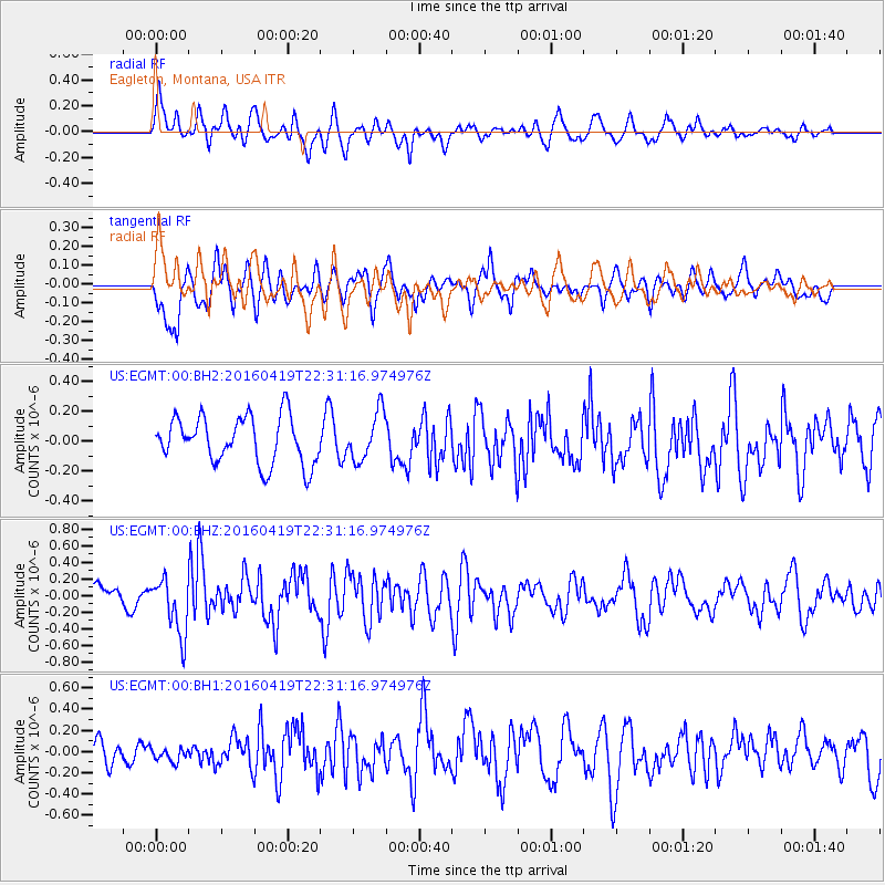
EGMT Eagleton, Montana, USA - Earthquake Result Viewer
*The percent match for this event was below the threshold and hence no stack was calculated.
| Earthquake location: |
Near Coast Of Ecuador |
| Earthquake latitude/longitude: |
0.6/-80.1 |
| Earthquake time(UTC): |
2016/04/19 (110) 22:22:26 GMT |
| Earthquake Depth: |
15 km |
| Earthquake Magnitude: |
5.5 MB |
| Earthquake Catalog/Contributor: |
NEIC PDE/NEIC ALERT |
|
| Network: |
US United States National Seismic Network |
| Station: |
EGMT Eagleton, Montana, USA |
| Lat/Lon: |
48.02 N/109.75 W |
| Elevation: |
1055 m |
|
| Distance: |
53.8 deg |
| Az: |
335.667 deg |
| Baz: |
142.138 deg |
| Ray Param: |
$rayparam |
*The percent match for this event was below the threshold and hence was not used in the summary stack. |
|
| Radial Match: |
65.05987 % |
| Radial Bump: |
400 |
| Transverse Match: |
59.325592 % |
| Transverse Bump: |
400 |
| SOD ConfigId: |
1475611 |
| Insert Time: |
2016-05-03 22:38:53.411 +0000 |
| GWidth: |
2.5 |
| Max Bumps: |
400 |
| Tol: |
0.001 |
|
Signal To Noise
| Channel | StoN | STA | LTA |
| US:EGMT:00:BHZ:20160419T22:31:16.974976Z | 2.2544544 | 3.4203825E-7 | 1.5171665E-7 |
| US:EGMT:00:BH1:20160419T22:31:16.974976Z | 0.45027098 | 5.8143833E-8 | 1.2913075E-7 |
| US:EGMT:00:BH2:20160419T22:31:16.974976Z | 1.0124047 | 1.5959452E-7 | 1.5763906E-7 |
| Arrivals |
| Ps | |
| PpPs | |
| PsPs/PpSs | |


